


Abstract
In arid and semi-arid regions, groundwater is the primary source for irrigation, drinking, and industrial use, yet water salinity and scarcity remain major challenges. However, no effort has been made to identify the natural and anthropogenic influences on groundwater salinity. In this brief background, the present study attempts to identify the factors and processes controlling the groundwater salinity in the Baicheng City, Jilin Province, China, from 2000, 2010, and 2018, using 7 hydrochemical parameters: electrical conductivity (EC), total dissolved solids (TDS), sodium (Na⁺), chloride (Cl⁻), bicarbonate (HCO₃⁻), calcium (Ca²⁺), and pH. Spatial distribution maps were generated using GIS-based interpolation, while linear regression analysis quantified the influence of chemical parameters on EC. The results reveal a significant increase in groundwater salinity over the study period. Non-saline areas declined from 40.0% (30,316.75km²) in 2000 to 7.71% (1,987.22km²) in 2018, whereas moderately saline areas expanded from 9.24% to 38.30%, becoming the dominant class. High- and very-high-salinity zones together accounted for 22–23% of the study area, primarily in southern Tongyu. Strong correlations between EC and TDS (R² = 0.99) and between EC and Ca²⁺ (R² = 0.86) highlight the primary chemical controls on salinity. The observed spatial patterns reflect the combined effects of natural hydrogeological factors and anthropogenic activities, including intensive irrigation and groundwater over-extraction. This integrated framework provides a robust basis for monitoring groundwater salinization and implementing targeted management strategies in semi-arid regions..
Keywords:Groundwater; Salinization; GIS; IDW; Baicheng city
Introduction
Groundwater is one of the most important freshwater resources for human activities, agriculture, and industrial purposes, particularly in semi-arid and arid areas. Microbial contamination frequently poses a safety challenge [1]. Salinity is currently increasing at a rate of 10% per year [2-6]. Numerous studies have demonstrated worldwide groundwater salinization, including in China [6-9], Pakistan [6-8], South America [9], and Australia [10]; in Africa: Morocco [11], Libya [12], and Egypt [7,8]. Therefore, reliable indicators are required to effectively evaluate and monitor groundwater salinity.
Electrical conductivity (EC) is widely used as a key indicator of groundwater salinity because it reflects the total dissolved salt concentration in water [9,10]. In combination with total dissolved solids (TDS) and major ions such as sodium (Na⁺), chloride (Cl⁻), calcium (Ca²⁺), bicarbonate (HCO₃⁻), and carbonate (CO₃²⁻), EC provides a comprehensive understanding of hydrochemical processes controlling salinity [11-13]. The assessment of both spatial and temporal variations in these parameters is critical for identifying salinization hotspots, supply understanding chemical dynamics, and evaluating the potential impacts on agricultural lands and water.
Innovative tools, such as Geographic Information Systems (GIS), are crucial for effective management. GIS analysis visualizespatterns and the spatial distribution of groundwater quality parameters [14]. Spatial GIS analysis maps water resources and identifies contamination zones, enabling proactive groundwater protection [15-19]. IDW enables accurate estimation of groundwater salinity at unsampled locations, facilitating the identification of regions with high salinity levels and temporal changes over multiple years [20-23]. However, comprehensive assessments integrating spatial mapping, temporal trend analysis, and hydrochemical characterization remain limited..
This study focuses on the challenges faced by groundwater salinity in Baicheng City, Jilin Province China. Groundwater in northeastern China, particularly in Baicheng City, Jilin Province, has shown increasing salinity levels [24,25]. Baicheng City, represents a region where groundwater is a primary water resource for both agriculture and domestic use [26,27]. This study utilizes GIS and other analytical tools to comprehensively evaluate the challenges of sustainable groundwater management in arid environments, specifically in the Baicheng City.
This study focuses on evaluating the spatial and temporal evolution of groundwater salinity in Baicheng City from 2000 to 2018. By using groundwater EC, TDS, and major ion data, combined with GIS-based IDW interpolation and linear regression analysis, the study aims to:This study aims to provide a detailed evaluation of groundwater salinity dynamics in Baicheng City from 2000 to 2018. Specifically, (i) maps the spatial and temporal distribution of EC and major ions, (ii) examines the chemical controls on groundwater salinity using correlation and regression analyses, and (iii) identifies salinization hotspots to support targeted management strategies. The results provide a quantitative basis for sustainable groundwater management in Baicheng City and other semi-arid regions facing progressive salinization.
Materials and Methods
Description of study area
The study area is situated in the northwestern region of Jilin Province, China. It lies west of the Songnen Plain and east of the Horqin Grassland, between longitudes 121°38′–124°23′E and latitudes 44°13′–46°18′N including five counties: Tongyu, Taonan, Taobei, Da’an, and Zhenlai (Figure 1). The total study area was approximately 25,600Km2. Most of the area is flat and dominated by plains. The area has a temperate continental monsoon climate, with four different seasons, short autumns, and climate change within the last few decades. The wet season start from June to August, while spring and autumn are dry and windy, respectively. The average annual precipitation from 400-500mm, and the surface evaporation is high, with an average evaporation from 1000 to 2000mm [28], which is 3.5-4.75 times the annual average evaporation. Therefore, salt easily accumulates on the surface to form a saline soil [29].

Data source
Data has been collected from the Water Resources Department of Baicheng City, Jilin Province, China, covering the period from 2000 2010 and 2018. A total of 57 groundwater samples from 2000, 2010, and 2018 were obtained from the Water Resources Bureau of Baicheng City, Jilin Province, China. The dataset includes major physicochemical parameters such as electrical conductivity (EC), total dissolved solids (TDS), Na⁺, Cl⁻, HCO₃⁻, Ca²⁺, and pH, which were used to evaluate groundwater salinity.
The statistical data of groundwater and soil salinity-related parameters are summarized in Table 1.

Assessment of soil salinity parameters
Electrical conductivity (EC) indicates the capacity of the soil solution and water to conduct electricity, which directly influences the concentration of soluble salts. EC is the basic measurement of salinity and is widely recognized as the criterion for assessing the effects of salt on crop yield and health [9]. It is commonly used to assess salinity; high EC indicates high salt concentration, which may affect plant water uptake by declining osmotic potential and inducing ion toxicity [30]. Total Dissolved Solids (TDS) is related to salinity and is commonly assessed by evaporating and weighing the soil solution; this method is more labor-intensive and less expedient than electrical conductivity (EC). A general conversion (TDS ≈ 640 × EC in mg/l) is used when salts such as NaCl predominate, although precision fluctuates with composition [9]. Sodium concentration directly influences the salinity and sodicity. The high Na⁺ level can affect water quality and soil structure by causing clay dispersion and decreasing permeability [23,31]. It also increases osmotic stress on plants and may exacerbate nutritional imbalance [32]. Chloride concentration ions are directly linked with salinity; high Cl⁻ can induce specific ion toxicity, especially in certain sensitive crops, and, when combined with Na⁺, they cause the issues of both sodicity and salinity [33]. Bicarbonate increases the precipitation and soil formation, including the formation of calcium carbonate, which affects soil quality, structure, and salinity dynamics [34]. It plays an important role in exchanging the sodium adsorption ratio (SAR). Calcium ions have adverse effects by improving clay flocculation. They also reduce sodicity and may reduce the salinity effects by removing Na⁺ from soil exchange sites [35]. Bicarbonate (HCO3⁻) affects the groundwater and are important in the precipitation of calcium carbonate [36]. pH level indicates the acidity or alkalinity, affecting the solubility the formation of minerals like calcium carbonate. High pH level may hence CaCO3 precipitation, impacting soil and groundwater properties and nutrient availability, especially in saline and irrigated conditions [23,32].
Temporal analysis using linear regression
To assess the long-term hydrochemical changes, linear regression analysis was applied to groundwater data (2000, 2010, and 2018). Each parameter (EC, TDS, Na⁺, Cl⁻, HCO₃⁻, Ca²⁺, pH) was determined by the following equation,
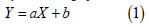
where 𝑌 is the parameter value, 𝑋 is the year, a is the intercept, and b is the slope. The coefficient of determination (R²) quantified the proportion of temporal variation explained by the model, providing where 𝑌 is the parameter value, 𝑋 is the year, a is the intercept, and b is the slope. The coefficient of determination (R²) quantified the proportion of temporal variation explained by the model, providing insights into increasing trends in groundwater salinity and ion concentration over time [37,38]. Regression results were integrated with GIS-based interpolation to visualize temporal changes in EC and other parameters across 2000 to 2018.
GIS-Based spatial analysis Data pre-processing
The Geographic Information System (GIS) plays a crucial role in the environmental field by integrating spatiotemporal data analysis with decision-making processes [39]. In this research, GIS was used for spatial and temporal analysis, which was conducted using ArcGIS 10.8 to analyze groundwater salinity factors. Groundwater data were stored in a spatial database and converted into point features for further analysis. To ensure spatial accuracy and consistency, all datasets were projected into the Xian_1980_GK_Zone_21 coordinate system. Data pre-processing included checking attribute consistency, correcting spatial errors, and preparing input datasets for spatial interpolation. Subsequently, spatial interpolation techniques were applied to generate continuous salinity distribution maps from point-based observations. These maps enabled the visualization of spatial variability and temporal changes in soil and groundwater salinity across the study area.
Spatial interpolation using IDW approach
Spatial Interpolation is a tool that use known point values to estimate unknown point values [40,41]. Interpolation tools are typically divided into geostatistical and deterministic approaches [41]. This study applied the Inverse Distance Weighting (IDW) interpolation method within a GIS framework to produce spatial distribution maps of salinity-related parameters, including electrical conductivity (EC), total dissolved solids (TDS), sodium (Na⁺), chloride (Cl⁻), bicarbonate (HCO₃⁻), calcium (Ca²⁺), and pH. The general IDW formula can be expressed as follows
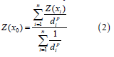
Whereas Z(x0) is estimated value for the unknown location at x0, Z(xi) is the observed value at the known sample location at xi, di is the distance between the known and unknown point values and p is the power factor that controls the rate at which the influence of neighboring points decreases with distance.
The weight assigned to each known point is inversely proportional to its distance from the prediction location. As the power parameter increases, the influence of distant points decreases more rapidly, whereas lower power values produce a more uniform distribution of weights among neighboring points [42]. The overall flowchart of the adopted methodology is illustrated in Figure 2.

Results
Spatial distribution of electrical conductivity (EC) Distribution of EC in 2000

In 2000, the spatial distribution of groundwater salinity based on EC in 2000 shows a clear north–south parts across the study area Figure 3a. The spatial distribution of groundwater salinity based on EC in 2000 shows a clear north–south gradient across the study area. Low EC values (non-saline to slightly saline) were mainly concentrated in the northern and north-central regions, particularly in Zhenlai and Taobei, while moderate EC levels occurred in the central areas around Taonan and Da’an. Higher EC concentrations were primarily observed in the southern region, especially in Tongyu. Non-saline areas covered 40.0% (30,316.75km²) of the study area, followed by slightly saline areas at 24.13% (6,219.77km²). Moderately saline zones accounted for 9.24% (2,445.42km²), whereas high and very highly saline areas represented 22.80% (5,876.12km²) and 3.53% (909.87km²), respectively, mainly concentrated in the southern part of the study area.
Distribution of EC in 2010
The spatial distribution of EC in 2010 Figure 3b, shows a clear expansion of saline groundwater zones. Non-saline areas decreased to 20.22% (5,210.57km²), mainly located in Zhenlai and Taobei. Slightly saline areas dominated the central region, including Taonan and parts of Da’an, covering 26.10% (6,727.27km²). Moderately saline zones accounted for 18.18% (4,684.95km²) and were mainly distributed in the central– southern transition areas. High salinity zones covered 19.32% (4,980.75km²), while very highly saline areas increased to 16.16% (4,164.40km²), primarily concentrated in Tongyu and southeastern Da’an.
Distribution of EC in 2018
The spatial distribution of EC in 2018 Figure 3c indicates a further expansion of groundwater salinity across the study area. Non-saline areas declined sharply to 7.71% (1,987.22km²), remaining mainly in small patches in Taobei and northern Taonan. Slightly saline areas covered 20.07% (5,178.67km²) and were mostly distributed in the northern and central regions. The moderately saline class became dominant, occupying 38.30% (9,870.15km²), particularly across Taonan and Da’an. High salinity zones accounted for 11.14% (2,871.72km²), while very highly saline areas expanded to 22.74% (5,860.18km²), mainly concentrated in Tongyu and the southern parts. Overall, the results indicate a progressive deterioration of groundwater quality from 2000 to 2018, with increasing moderate and very high salinity levels.
Spatial distribution of total dissolved solids (TDS) Distribution of TDS in 2000
The spatial distribution of groundwater salinity based on TDS in 2000 figure 4a, shows a pattern similar to EC. Non-saline groundwater dominated the northern areas, particularly Zhenlai and Taobei, covering 10,308.21km² (40.04%) of the study area. Slightly saline conditions were mainly distributed in the central regions, occupying 6,214.63km² (24.14%), while moderately saline areas accounted for 2,443.40km² (9.49%), primarily around Taonan. High salinity zones were concentrated in Tongyu, covering 5,871.26km² (22.80%), whereas very highly saline areas were limited to 909.12km² (3.53%), mainly occurring as localized hotspots in the southern part of the study area.

Distribution of TDS in 2010
The spatial distribution of TDS in 2010 figure 4b, indicates an increase in groundwater salinity across the study area. Slightly saline areas became dominant, covering 6,721.71km² (26.11%), mainly in the central and northeastern regions. Non-saline areas decreased to 5,206.26km² (20.22%), remaining primarily in Zhenlai and parts of Taobei. Moderately saline zones expanded to 4,681.07km² (18.18%), mostly in the central transition areas. High salinity areas accounted for 4,976.63km² (19.33%), while very highly saline zones increased to 4,160.95km² (16.16%), mainly concentrated in Tongyu and southeastern Da’an.
Distribution of TDS in 2018
The spatial distribution of TDS in 2018 figure 4c, shows a clear dominance of moderately saline groundwater, covering 9,861.98km² (38.30%), mainly across Taonan and Da’an. Very highly saline areas increased to 5,855.33km² (22.74%), largely concentrated in Tongyu and southern regions. Slightly saline zones occupied 5,174.39km² (20.10%), mostly in the northern part of the study area. High salinity areas accounted for 2,869.35km² (11.14%), while non-saline areas declined sharply to 1,985.58km² (7.71%), indicating a significant reduction in fresh groundwater resources.
Spatial distribution of sodium (Na⁺) Distribution of Sodium Na+ in 2000
The spatial distribution of sodium (Na⁺) in 2000 Figure 5a shows higher concentrations in the southern region, particularly in Tongyu, while lower levels occurred in the northern areas such as Zhenlai and Taobei. Non-saline areas covered 7,374.39km² (28.64%), followed by slightly saline zones with 4,765.83km² (18.51%). Moderately saline areas accounted for 4,513.01km² (17.53%), mainly in the central regions. High salinity zones occupied 3,121.44km² (12.12%), whereas very highly saline areas covered 5,971.95km² (23.20%), indicating considerable sodium accumulation in the southern groundwater systems.

Distribution of Sodium Na+ in 2010
The spatial distribution of Na⁺ in 2010 Figure 5b indicates an expansion of moderate and high sodium concentrations. Moderately saline areas became dominant, covering 7,004.95km² (27.21%), mainly in the central and southern regions. Slightly saline zones accounted for 6,713.74km² (26.08%), while high salinity areas covered 5,505.44km² (21.38%). Very highly saline zones represented 4,603.56km² (17.88%), largely concentrated in Tongyu. Non-saline areas were limited to 1,918.94km² (7.45%), mostly in the northern regions.
Distribution of Sodium Na+ in 2018
The spatial distribution of Na⁺ in 2018 Figure 5c shows a further expansion of salinity, with moderately saline areas dominating, covering 10,916.71km² (42.40%), mainly in Taonan and Da’an. High salinity zones accounted for 5,841.56km² (22.69%), while slightly saline areas covered 4,904.19km² (19.05%). Non-saline areas were limited to 2,204.35km² (8.56%), mostly in northern Zhenlai and Taobei, whereas very highly saline zones occupied 1,879.82km² (7.30%), primarily in southern Tongyu.
Spatial distribution of chloride (Cl⁻) Distribution of Chloride (Cl-) in 2000
In 2000 figure 6a, chloride concentrations exhibited a heterogeneous spatial pattern, with low levels in the northern regions (Zhenlai and Taobei) and higher concentrations in the south, particularly in Tongyu. Non-saline areas covered 4,999.81km² (19.42%), slightly saline zones 6,070.47km² (23.58%), and moderately saline areas 6,048.02km² (23.49%). High salinity zones accounted for 2,761.41km² (10.73%), while very highly saline areas occupied 5,866.92km² (22.79%), concentrated mainly in southern Tongyu.

By 2010 Figure 6b, slightly saline zones became dominant, covering 7,388.88km² (28.70%), while moderately saline areas accounted for 6,094.38km² (23.67%). Non-saline areas decreased to 4,883.18km² (18.97%). High salinity zones expanded to 3,406.85km² (13.23%), and very highly saline zones increased to 3,973.33km² (15.43%), largely in southern and southeastern regions, indicating a progressive salinization trend.
Distribution of Chloride (Cl-) in 2018
In 2018 Figure 6c, moderately saline areas became the most extensive class, covering 9,563.53km² (37.14%), mainly in central Taonan and Da’an. Very highly saline zones increased to 5,565.57km² (21.62%), concentrated in Tongyu, while slightly saline areas accounted for 4,623.85km² (17.96%). High salinity zones covered 3,430.76km² (13.33%), and non-saline areas were limited to 2,562.93km² (9.95%), primarily in the northern regions. Overall, the maps indicate a gradual southward expansion of high and very high chloride concentrations over the 18-year period.
Influence of hydrochemical parameters on groundwater salinity
Linear regression was performed to quantify the influence of major chemical parameters on EC (μS/cm), using TDS, Na⁺, Cl⁻, Ca²⁺, HCO₃⁻, and pH as independent variables Table 2, and the relationships between EC and the major parameters are illustrated in Figure 7. Regression analysis revealed a very strong correlation between EC and TDS (R² = 0.99), confirming that dissolved solids are the primary driver of groundwater salinity. Calcium also exhibited a strong correlation with EC (R² = 0.86), while pH showed a strong positive correlation (R² = 0.81). Sodium and chloride displayed moderate correlations with EC (R² = 0.63 and 0.56, respectively), indicating secondary contributions, whereas bicarbonate had a weak correlation (R² = 0.31), reflecting a minor effect.

Overall, TDS and Ca²⁺ are the dominant factors controlling EC, with Na⁺, Cl⁻, and pH exerting moderate effects, and HCO₃⁻ contributing minimally. These results are consistent with the spatial distribution patterns, providing a quantitative basis for understanding the chemical controls on groundwater salinization in Baicheng City.

Discussion
The spatio-temporal analysis of groundwater salinity in Baicheng City reveals distinct patterns between 2000, 2010, and 2018. Low to moderate EC (<380μS/cm) and TDS (<240mg/L) values dominated the northern and central regions, whereas southern Tongyu remained the most affected area. This pattern is consistent with studies conducted in semi-arid regions of Northeast China, where low-lying plains and areas with intensive irrigation are prone to salinity accumulation due to high evapotranspiration and limited groundwater recharge [43-45].
Hydrochemical analysis indicates that TDS is the primary factor controlling EC, reflecting the dominant influence of dissolved ionic concentrations on groundwater salinity [46,47]. Calcium (Ca²⁺) and pH show strong correlations with EC, highlighting their roles in hydrochemical processes and salt solubility [49,49]. Sodium (Na⁺) and chloride (Cl⁻) exhibit moderate correlations, suggesting a secondary contribution to salinity, whereas bicarbonate (HCO₃⁻) shows a relatively weak relationship with EC [49,50]. These results are consistent with the spatial distribution maps, where high EC values coincide with elevated TDS and Ca²⁺ concentrations.
The observed salinization pattern is influenced by both natural hydrogeological conditions and anthropogenic activities [51]. The flat topography of southern Tongyu, combined with intensive irrigation and groundwater over-extraction, promotes salt accumulation, while regional groundwater flow may facilitate the northward migration of salinity [52]. These findings indicate that groundwater salinization in the study area is both localized and progressive.
From a management perspective, these results highlight the importance of regulating groundwater extraction, improving irrigation practices to minimize salt accumulation, and implementing targeted mitigation strategies in high-salinity zones [53-55]. Understanding the key chemical drivers of salinity, particularly TDS and Ca²⁺, can support the development of more effective groundwater management and remediation strategies.
Conclusion
This study assessed the spatial and temporal dynamics of groundwater salinity in Baicheng City, from 2000, 2010, to 2018. The results reveal a clear increase in salinity, with high-salinity zones consistently concentrated in southern Tongyu and gradually expanding northward and eastward, indicating the vulnerability of low-lying plains to progressive salinization. Hydrochemical analysis shows that total dissolved solids (TDS) are the dominant contributor to electrical conductivity (EC), while calcium (Ca²⁺) and pH exert strong influences on groundwater salinity. Sodium (Na⁺) and chloride (Cl⁻) show moderate contributions, whereas bicarbonate (HCO₃⁻) has a relatively minor effect. The spatial patterns reflect the combined influence of natural hydrogeological conditions, including topography and groundwater flow, and human activities such as intensive irrigation and groundwater over-extraction. These findings highlight the need for improved groundwater management, including regulated pumping, optimized irrigation practices, and continuous monitoring of hydrochemical parameters to mitigate salinization and protect water resources in Baicheng City and similar semi-arid regions.
Author Contribution
Conceptualization, M.S., Z.F. and Y.S.; Data curation and software, M.S.; Formal analysis, Y.S. and K.H.; Supervision, Z.F.; Validation, Z.M. and K.H.; Review and editing, M.S.; Visualization, Y.S. and K.H.; Writing—Original draft, M.S.; Writing—Review and editing, Y.S. and K.H. All authors have read and agreed to publish this version of the manuscript.
Acknowledgement
We would like to express our sincere gratitude to the College of New Energy and Environment at Jilin University for providing the essential data and facilities for this research. Their support and co-operation were instrumental in facilitating this study on the assessment of soil salinization in Baicheng City.
Data Availability
The data presented in this study are available upon request from the corresponding author.
Declaration
Ethics Approval: Not applicable.
Consent to Participate: All authors reviewed and approved the final manuscript.
Competing Interests: The authors declare no competing interests.
References
- Baloch MYJ, Baidya P, Aryal M, Moeen-ud-din M, Yang L, Iqbal J, et al. (2025) Fate and transport of viruses in the subsurface environment: a systematic review of pollution pathways in saturated and unsaturated porous media. Environmental Research 288(Pt 1): 123163.
- Priyan K (2021) Issues and challenges of groundwater and surface water management in semi-arid regions. Groundwater resources development and planning in the semi-arid region, p. 1-17.
- Skliris N, Marsh R, Josey SA, Good SA, Liu C, et al. (2014) Salinity changes in the World Ocean since 1950 in relation to changing surface freshwater fluxes. Climate dynamics 43(3): 709-736.
- Krishan G (2019) Groundwater salinity. Current World Environment 14(2): 186.
- Jat Baloch MY, Zhang W, Chai J, Li S, Alqurashi M, et al. (2021) Shallow groundwater quality assessment and its suitability analysis for drinking and irrigation purposes. Water 13(23):
- Jat Baloch MY, Zhang W, Zhang D, Al Shoumik BA, Iqbal J, et al. (2022) Evolution mechanism of arsenic enrichment in groundwater and associated health risks in southern Punjab, Pakistan. International Journal of Environmental Research and Public Health 19(20): 13325.
- Said I, SA Salman (2021) Salinization of groundwater under desert reclamation stress at Qena region, Egypt. Journal of African Earth Sciences 181: 104250.
- Said R (2012) The geological evolution of the River Nile. Springer Science & Business Media.
- Corwin DL, K Yemoto (2020) Salinity: Electrical conductivity and total dissolved solids. Soil Science Society of America Journal 84(5): 1442-1461.
- Iqbal J, Su C, Rashid A, Yang N, Baloch MYJ, et al. (2021) Hydrogeochemical assessment of groundwater and suitability analysis for domestic and agricultural utility in Southern Punjab, Pakistan. Water 13(24): 3589.
- Poursaeid M, Mastouri R, Shabanlou, Najarchi M (2020) Estimation of total dissolved solids, electrical conductivity, salinity and groundwater levels using novel learning machines. Environmental Earth Sciences 79(19): 453.
- Rhoades JD (1996) Salinity: Electrical conductivity and total dissolved solids. Methods of soil analysis: Part 3 Chemical methods 5: 417-435.
- Oyem H, I Oyem, D Ezeweali (2014) Temperature, pH, electrical conductivity, total dissolved solids and chemical oxygen demand of groundwater in Boji-Boji Agbor/Owa area and immediate suburbs. Research Journal of Environmental Sciences 8(8): 444-450.
- Iqbal J, Su C, Abbas H, Jiang J, Han Z, et al. (2025) Prediction of nitrate concentration and the impact of land use types on groundwater in the Nansi Lake Basin. Journal of Hazardous Materials 487: 137185.
- Nas B, A Berktay (2010) Groundwater quality mapping in urban groundwater using GIS. Environmental Monitoring and Assessment 160(1-4): 215-227.
- Machiwal D, Cloutier V, Guler C, Kazakis N (2018) A review of GIS-integrated statistical techniques for groundwater quality evaluation and protection. Environmental Earth Sciences 77(19):
- Ali A, Baloch MYJ, Naveed M, Niger A, Almalki AS, et al. (2025) Advanced satellite-based remote sensing and data analytics for precision water resource management and agricultural optimization. Scientific Reports 15(1): 27527.
- Iqbal J, Amin G, Su C, Haroon E, Baloch MYJ (2024) Assessment of landcover impacts on the groundwater quality using hydrogeochemical and geospatial techniques. Environmental Science and Pollution Research 31(28): 40303-40323.
- Jat Baloch MYJ, Zhang W, Al Shoumik BA, Nigar A, Elhassan AAM, et al. (2022) Hydrogeochemical mechanism associated with land use land cover indices using geospatial, remote sensing techniques, and health risks model. Sustainability 14(24): 16768.
- Elumalai V, Brindha K, Sithole B, Lakshmanan E (2017) Spatial interpolation methods and geostatistics for mapping groundwater contamination in a coastal area. Environmental Science and Pollution Research 24(12): 11601-11617.
- Ahmad AY, Saleh IA, Balakrishnan P, Al-Ghouti MA (2021) Comparison GIS-Based interpolation methods for mapping groundwater quality in the state of Qatar. Groundwater for Sustainable Development 13: 100573.
- Baloch MYJ, Zhang W, Chai J, Al Shoumik BA, Tariq A, et al. (2025) Groundwater contamination, fate, and transport of fluoride and nitrate in Western Jilin, China: Implications for water quality and health risks. Environmental Chemistry and Ecotoxicology 7: 1189-1202.
- Baloch MYJ, Zhang W, Sultana T, Akram M, Al Shoumik BA, et al. (2023) Utilization of sewage sludge to manage saline–alkali soil and increase crop production: Is it safe or not? Environmental Technology & Innovation 32: 103266.
- Ma J (2015) Expansion of Paddy Farming in the Northeast Region of China and Its Impact on the Local Environment: Case Studies of Baicheng and Da'an Cities, Jilin Province. WILAYAH: The International Journal of East Asian Studies 4(1): 55-62.
- Yan J, J Chen, W Zhang (2021) Study on the groundwater quality and its influencing factor in Songyuan City, Northeast China, using integrated hydrogeochemical method. Science of the Total Environment 773: 144958.
- Bing B, Cheng YP, Jiang ZC, Zhang (2017) Climate change and groundwater resources in China. Journal of Groundwater Science and Engineering 5(1): 44-52.
- Sun Q, Xu C, Gao X, Lu C, Cao B, et al (2022) Response of groundwater to different water resource allocation patterns in the Sanjiang Plain, Northeast China. Journal of Hydrology: Regional Studies 42: 101156.
- Liu X, et al. (2015) Analysis on the Evolution Characteristics and Trend of the 52-year Precipitation Distribution in the West of Jilin Province. Water Resour Power 33: 11-14.
- Zhang TT, Zeng SL, Gao Y, Ouyang ZT, Li B, et al. (2011) Using hyperspectral vegetation indices as a proxy to monitor soil salinity. Ecological Indicators 11(6): 1552-1562.
- Omar MM, Massawe BH, Shitindi MJ, Pedersen O, Meliyo JL, et al. (2024) Assessment of salt-affected soil in selected rice irrigation schemes in Tanzania: understanding salt types for optimizing management approaches. Frontiers in Soil Science 4: 1372838.
- Hakami A (2024) Strategies for overcoming data scarcity, imbalance, and feature selection challenges in machine learning models for predictive maintenance. Scientific Reports 14(1): 9645.
- Atta K, Mondal S, Gorai S, Singh AP, Kumari A, et al. (2023) Impacts of salinity stress on crop plants: improving salt tolerance through genetic and molecular dissection. Frontiers in Plant Science 14: 1241736.
- Hanson B, Bowers W, Gratten G, Grimes D, Tanji K (1991) Trace elements limit potential for blending San Joaquin drainwater with canal water. The Journal of UC Agriculture and Natural Resources 45(2): 17-19.
- Zhang W, Feng H, Chang J, Qu J, Xie H, et al. (2009) Heavy metal contamination in surface sediments of Yangtze River intertidal zone: an assessment from different indexes. Environmental Pollution 157(5): 1533-1543.
- El-Swaify S (2000) Soil and water salinity. Plant Nutrient Management in Hawaii’s Soils, Approaches for Tropical and Subtropical Agriculture 2000: 151-158.
- Dvořáčková H, Dvořáček J, González PH, Vlček V (2022) Effect of different soil amendments on soil buffering capacity. PloS one 17(2): e0263456.
- Sahour H, V Gholami, M Vazifedan (2020) A comparative analysis of statistical and machine learning techniques for mapping the spatial distribution of groundwater salinity in a coastal aquifer. Journal of Hydrology 591: 125321.
- Gao L, Yuan Z, Mao X, Ma T (2025) Salinity levels, trends and drivers of surface water salinization across China's river basins. Water Research 281: 123556.
- Burrough PA, RA McDonnell, CD Lloyd (2015) Principles of geographical information systems. Oxford university press.
- Lu GY, DW Wong (2008) An adaptive inverse-distance weighting spatial interpolation technique. Computers & Geosciences 34(9): 1044-1055.
- Johnston K, Ver Hoef JM, Krivoruchko K, Lucas N (2001) Using ArcGIS geostatistical analyst. Vol. 380: Esri Redlands.
- ShepardD (1968) A two-dimensional interpolation function for irregularly-spaced data. In Proceedings of the 1968 23rd ACM national conference. 1968.
- Qin Z, Nie T, Wang Y, Zheng H, Tong C, et al. (2025) The characteristics and driving factors of soil salinisation in the irrigated area on the southern bank of the yellow river in inner Mongolia: A assessment of the Donghaixin irrigation district. Agriculture 15(5): 566.
- Liu Y, Liu X, Wang S, Cui G, Yan L, et al. (2025) Hydro-salinity dynamics in a semi-arid agricultural plain: implications for sustainable land management. Ecological Indicators 178: 114100.
- Yu H, Wang Z, Mao D, Jia M, Chang S, et al. (2023) Spatiotemporal variations of soil salinization in China's West Songnen Plain. Land Degradation & Development 34(8): 2366-2378.
- Wen X, Wu Y, Su J, Zhang Y, Liu F (2005) Hydrochemical characteristics and salinity of groundwater in the Ejina Basin, Northwestern China. Environmental Geology 48(6): 665-675.
- Heydarirad L, Mosaferi M, Pourakbar M, Esmailzadeh N, Maleki (2019) Groundwater salinity and quality assessment using multivariate statistical and hydrogeochemical analysis along the Urmia Lake coastal in Azarshahr plain, North West of Iran. Environmental Earth Sciences 78(24): 670.
- Zhang T, Wang P, He J, Dandan L, Wang M, et al. (2023) Hydrochemical characteristics, water quality, and evolution of groundwater in Northeast China. Water 15(14): 2669.
- Gilbert K, Bennett PC, Wolfe W, Zhang T, Ramanak KD, et al. (2016) CO2 solubility in aqueous solutions containing Na+, Ca2+, Cl−, SO42− and HCO3-: The effects of electrostricted water and ion hydration thermodynamics. Applied Geochemistry 67: 59-67.
- Thomas R (1977) The role of bicarbonate, chloride and sodium ions in the regulation of intracellular pH in snail neurones. The Journal of Physiology 273(1): 317-338.
- Zhang Y, Hou K, Qian H, Gao Y, Fang Y, et al. (2023) Natural-human driving factors of groundwater salinization in a long-term irrigation area. Environmental Research 220: 115178.
- Li C, Gao X, Li S, Bundschuh (2020) A review of the distribution, sources, genesis, and environmental concerns of salinity in groundwater. Environmental Science and Pollution Research 27(33): 41157-41174.
- Mohanavelu A, SR Naganna, N Al-Ansari (2021) Irrigation induced salinity and sodicity hazards on soil and groundwater: An overview of its causes, impacts and mitigation strategies. Agriculture 11(10): 983.
- Demo AH, Gemeda MK, Abdo DR, Guluma TN, Adugna DB (2025) Impact of soil salinity, sodicity, and irrigation water salinity on crop production and coping mechanism in areas of dryland farming. Agrosystems, Geosciences & Environment 8(1): e70072.
- Sun Y, Wang L, Yang S, Qu Z, Zhang D (2025) Optimizing Irrigation and Drainage Practices to Control Soil Salinity in Arid Agroecosystems: A Scenario-Based Modeling Approach Using SaltMod. Agronomy 15(9): 2239.


