


Investigation of Farming System Dynamics and Soil Carbon Rich Land Use Type in North Western Ethiopia, in Blue Nile basin
Eyob Tilahun Abera1 and Dereje Dejenie Kassa2*
1Department of Natural Resource Management, Debre Tabor University, Ethiopia
2Department of Natural Resource Management, Wolkite University, Ethiopia
Submission: June 28, 2019; Published: September 04, 2019
*Corresponding author: Dereje Dejenie Kassa, Department of Natural Resource Management, Wolkite University, Ethiopia
How to cite this article: Eyob Tilahun Abera, Dereje Dejenie Kassa. Investigation of Farming System Dynamics and Soil Carbon Rich Land Use Type in North Western Ethiopia, in Blue Nile basin. Int J Environ Sci Nat Res. 2019; 21(2): 556059. DOI:10.19080/IJESNR.2019.21.556059
Abstract
This study was carried out in a Tirurwuha catchment in North West Ethiopia with areal coverage of 2,668 ha in the upper Blue Nile basin. The objectives of the study were to
(i) investigate land use land cover change (LULCC) in between 1986, 1999 and 2013 and
(ii) estimate soil carbon rich land use type. Remote sensing, ArcGIS 10.2.1, ERDAS imagines 2015 tools were used to analyze LULCC.
Land-sat images acquired in 1986, 1999 and 2013 data were used. Soil laboratory data were used. In field, composite soil samples were collected purposefully at, each land use at a depth of 0-30 cm to analyze soil organic carbon. Bulk density was determined from undisturbed soil samples. The result of LULCC showed that, forest cover increased from 9.7% and farmland was diminished from 77.1%. Relatively high amount of soil carbon stock (SCS) was observed in the forest land with a mean value of 112.03g/cm2 followed by grazing land with a mean value of 99.62g/cm2. But, mean value of SCS of farmland was almost one-half (50.64g/cm2) of that of grazing land. A possible reason to increase forest and grazing land coverage could be due to lands with less crop production that caused by soil acidity.
Keywords: Land-use and land-covers dynamics; Soil carbon rich land use type; Remote sensing; Geographical information system; Soil carbon stock
Abbreviations:BD: Bulk Density; SOC: Soil Organic Carbon; Cs: Soil Carbon; CSA: Central Statistics Agency; D: Depth; GHG: Greenhouse Gas; GIS: Geographical Information System; GPS: Global Positioning System; Ha: Hectare; LU: Land Use; LULCC: Land Use Land Cover Change; M: Meter; OC: Organic Carbon; WBISPP: Woody Biomass Inventory and Strategic Planning Project
Introduction
Land use land cover change (LULCC) in ecosystem services has been detected as one current alarming issue in glob (World Resources Institute, 2000-2001). It has negative consequences on both quality of environment and life [1]. LULCC can affect food security, biodiversity, biogeochemical cycles, soil fertility, hydrological cycles, energy balance, land productivity and the sustainability of environmental service provision [1,2]. In addition to this, it also contributes to global warming [1].
Several decades and at least dozens of research findings have revealed that LULCC resulted for global climate change [3] and it accounts one-third of climate change in the glob (Tan and Lal, 2005). Land use changes (LUC) related to agricultural practices was responsible for 24% of global greenhouse gas (GHG) emissions in 2010. In between 1970 to 2011, CO2 emissions increased by about 90% and LUC have been the second largest source of global carbon emissions, next to the use of fossil fuels in the world. Land use change from forest to farmland in tropics has been responsible for 15% to 25% of annual global GHG emissions, and accounts for nearly 70% of total GHG emissions in Africa [4]. Soil is one of terrestrial ecosystem that can be served as a sink or source of atmospheric carbon dioxide [5,6].
Findings on LULCC in north western parts of Ethiopia revealed that shifting of cultivated land from 39% in 1957 to 77% in 1995 whereas natural forest diminished from 27 to 0.3% in that year order [7]. The other study conducted in the upper Gilgel Abbay catchment of Blue Nile basin in Ethiopia showed that the diminishing of forest covers from 50.9 to 16.7% in between 1973 and 2001 periods due to the expansion of farmland [8]. Similar other study in the South-Central Rift Valley Region of Ethiopia also disclosed that downing trend of natural forest covers from 16% in year 1972 to 2.8% in the year 2000 [9].
Except LULCC map of Ethiopia, which generated by Woody Biomass Inventory and Strategic Planning Project (WBISPP) in (2005) [10], most LULCC studies conducted by different authors in the South Gonder in Ethiopia were limited either spatially or temporally for certain areas excluding current study area. And also, none of those studied, investigated the impact of LULCC on soil carbon stock at different land use types. This study was limited to examining soil carbon stock in the highland area of the country. So, this study was initiated to fill those big gaps with following specific objectives of to analyze LULCC in between 1986, 1999 and 2013 and, to estimate soil carbon stock at different land use types.
Methodology
Location of the study area
The study was conducted in 2016 in a Tikurewuha catchment in Awzet Kebele, Farta district, South Gonder, and Ethiopia. It is located 673km far away from the Addis Ababa city and geographically located between latitude 11.44o to 11.48o and longitudes 38.60o to 38.90o (Figure 1).

Biophysical characteristics of study area
The total areal coverage of the study watershed is 2,668.5 hectares. According to Farta district agricultural office unpublished report in (2012), the study area receives 1500mm rainfall annually with a mean annual temperature of 15.5oC. Composition of vegetation in the study area was dominated by plantation forest, but some indigenous tree species were restricted to churches, farm lands homesteads and community woodlot. The most dominate exotic tree species in the study area was Eucalyptus globulus. This tree species grows faster than the indigenous trees and serves as a cash generating tree for local farmers.
Sources and types of data
Data from primary sources include satellite imagery, field and laboratory data. Secondary data such as census records and unpublished official documents and reports were collected from the Central Statistical Authority (CSA) of Ethiopia.
Data collection and processing
Data collection
Three time series Landsat images of 1986, 1999 and 2013 were used to analyze LULCC of the entire study area. All images used in this study had 30 m spatial resolution and below 5% cloud cover. Reconnaissance survey was carried out in December to January 2016 to obtain a general understanding of the current land use study of the pattern area. Digital image processing and visual interpretation of satellite image was made by using ERDAS imagine 2015. ARCGIS version 10.2.1 and Garmin GPS were used to collect ground control points. Land use and land cover classification were interpreted according to the legend established through merging similar types of spectral properties.
Image pre-processing
Image enhancement and geometric refinement were carried out. Geometric correction of image pixel positions was done by adjusting the optical geometry to minimize the distortions due to the motion of the image platform. The boundary of the study area was delineated in a 1:50,000 topographic maps [11].
Image classification and analysis
Both unsupervised and supervised image classification methods were carried out as outlined by Rogan & Chen [12]. To have an overall representative land use, land cover cluster of pixels, unsupervised classification was carried out first and then followed by supervised classification to categorize the images using ground truths. Supervised classifications were based on the results of unsupervised classification and supplementary data (Google Earth).
Accuracy assessment
The classified land use and land cover maps may contain some sort of errors that can be caused by several factors. From methods of satellite data collection of a classification technique may errors may be introduced. So, the error was quantitatively described through classification accuracy assessment to use the classified land use, land cover maps by using standard methods of Congalton [13]. References were identified from Google Earth using Global Positioning System (GPS) in the field for accuracy assessment purpose. Total accuracy was computed and to meet the minimum 85% accuracy as indicated by Anderson et al. [14].
Land use land, cover change detection
Land use types which converted from one class to any of the other classes were computed in a hectare (ha) and percent (%) base and the change directions were also determined following the standard procedure and map was produced using (Figure 2).

Estimation of soil carbon stock
The soil organic carbon sequestration was estimated by using the following equation (Guo and Gifford, 2002)
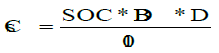
Where Cs is soil organic carbon stocks per unit area, SOC is soil organic carbon concentration in %, BD is soil bulk density in g/cm3, D is the soil sampling depth in cm.
Soil sampling at field level
About 5 main sampling points were distributed systematically at, each land use types by using ARCGIS version 10.2.1. I.e., total of 15 main sampling points were located. About 10 to15 sub-soil samples were collected for each main sample based on the complexity of the topography and variability of the soil type at the depth of 0-30 cm. For landscapes having a homogenous soil type and uniform topography; 10 sub-samples were collected within 10 to 50 m distance between each sub-plot in a zigzag manner. But, for undulating topography where the slope varies in short distance and heterogeneous soil type, 15 sub-samples were collected within a relatively short distance that ranges 10 to 20 m between and among each sub-sampling points. Samples from each sub-sample were composed into one bucket for each main plot and it was thoroughly mixed and around 1kg representative mixed soil sample was collected.
Soil sample preparation and analysis
Total of 15composite soil samples were packed, labelled and shipped to the Behar Dar soil laboratory in Ethiopia for analysis. Soil samples were air dried, crushed and passed through 0.5mm diameter sieve for analysis of organic carbon (OC) in the soil. Soil OC content was analyzed by the wet digestion method of [15]. Then the mean value of OC was calculated for each land use type. The bulk density of the soil was estimated from undisturbed soil samples collected using a core sampler for each land use types by following the procedure of [16].
Results and Discussion
Land use, land cover in 1986, 1999 and 2013
Farm land, forest land and grassland coverage were 77.1%, 9.7% and 13.2% in year 1986, 65.4%, 19.4% and 15.2% in year 1999, and 51.7%, 29.1% and 19.2% in year 2013, respectively (Table 1). Those times serious land use, land cover data showed that the increasing trend of forest and grassland coverage from year to year while farm land showed diminishing pattern.
Land use land cover change in between 1986 to 2013
Farm land
It was declined from 312.3 ha (15%) and 364.5 ha (18%) from1986 to 1999 and 199 to 2013, respectively. However, farm land decreased from 1999 to 2013 was larger than that of 1986 to 1999 (Table 1). After 27 years (in 2013), farm land was turned downed by 676.8 ha (33%) due to different factors that forced local farmers to shift their land towards plantation forest and grazing land. Perhaps, high rainfall that leased their land to be acidic and less productive could be one of the major driving forces of the shrinking of farm land. This finding was contrary to the most of land use land cover change findings in different parts of Ethiopia that carried out by different scholars, including (Kidane et al. 2012) [17-23].
Forest land
Increase in forest land was detected in both from 1986 to 1999 and 1999 to 2013 at the expense of cultivated land. Forest land was enlarged by 258.8 ha (100%) and 261.3 ha (101%) in 1999 and 2013, respectively. In general, forest land was amazingly optimized by 520.1 ha (201%) in 2013 when it compared with that of initial year status (Table 1). This remarkable achievement could be due to a forestation program of the Derg regime, an initiative to preserve indigenous trees or forests and planting of trees at the household level especially in highland parts of Ethiopia including the study area. In addition to this, lands with less crop production due to soil acidity were forced local farmers to convert their land to eucalyptus plantation. This finding agreed with that of Amare Sewnet (2015) in Infraz Watershed, North western Ethiopia and Woldeamlak [24] in Chemoga watershed in Ethiopia. But, it was contrary to the most of land use land cover change findings in different parts of Ethiopia, which conducted by different scholars like [17-23].
Grassland
Similar to that of forest land use change, grassland was showing increasing pattern in 1999 and 2013 in expense of farm land. While, grassland increased from 1999 to 2013 was larger than that of 1986 to 1999. It increased by 53.6 ha (15%) and 103.6 ha (29%) in 1999 from that of 1986 and in 2013 from that of 1999, respectively. A Total of 520.1 ha (201%) grassland was increased at the end of 2013 when it compared with that of initial coverage (Table 1). This finding was in agreement with that of Amare Sewnet (2015) in Infraz Watershed, North western Ethiopia. But it was contrary to most of the findings related to land use land cover change in different parts of the Ethiopia.
Soil carbon rich land use type
As estimated result of soil carbon stock revealed that relatively high amount of soil carbon was observed in the forest land use type with a mean value of 112.03g/cm2 followed by grazing land (99.62g/cm2). While soil carbon sequestered in farm land (50.64g/cm2) was almost one-half of that of grazing land soil carbon stock. So, relatively small amount of soil carbon was sequestered in farm land use type (Table 2). Hence, the conversion of farmland to forest land has positive attributes for soil carbon stock followed by land use change types of farmland to grassland use type. Soil carbon stocks in forest land and grassland uses have no statistical significance difference. Those results revealed that the current farmers farming system conversion provided an opportunity to sequester additional carbon into a soil that in turn can alleviate current climate change problems [25,26]
Conclusion
Land- use and land-cover changes in the study area were contrary to the historical trend of conversion of forest and grassland to farmland in different parts of the country as at least dozens of research findings agreed. Forest land use type showed remarkable soil carbon stock and it is easy to imagine that huge amount of carbon could be sequestered in forest land considering the carbon stocked in above ground biomass in addition to stocked in the soil. Even if forest cover showed an increasing pattern, there are no land use plan sustainable, soil water conservation practices and continuous and strong soil acidity reclamation campaigns in the study area yet. Due to this, most of lands are going out of productive land. If current trend and perception is not averted, the huge agricultural potential of this part of land will soon be severely degraded, perhaps beyond recovery in some places. Despite the fact that the existing trend of land use land cover change had a positive impact to mitigate climate change, it could have a negative impact on Scio-economy of the local community.
Recommendations
Even if increases in forest cover due to exotic eucalyptus tree plantation could be viewed as positive for climate change mitigation efforts, indigenous forests contain many endemic species and maintain biodiversity, which is important for sustainable ecosystem functioning. Exotic eucalyptus plantations have been linked to environmental changes that could harm ecosystem functioning. In line this, Eucalyptus has been found to deplete groundwater as many of the findings revealed. Hence, depletion of the groundwater table could impact native forest health as well as agricultural productivity. So, introduction of proper land management and integrated environmental rehabilitation strategies must be given high priority Moreover, endogenous tree plantation must get high priority to preserve existing biodiversity and regeneration.
Acknowledgments
The authors highly acknowledge Debre Tabor University for awarding him research fund. This important study would not have been initiated and carried out in its full breadth without Debre Tabor University’s support. Their deep gratitude and appreciation extend to the Ethiopian Mapping agency for timely selling of Landsat images. They would also like to thank study area farmers for their factual information. Last but by no means the least, would the authors like to express their deep sense of thanks to Debre Tabor University College of agriculture and environmental sciences dean (Mr. Melaku Minale) for his timely response and supporting when his assistance was demanded.
Data Availability
The data used to support findings of this study are available from the corresponding author upon request.
Funding
Funding was received from Debre Tabor University.
References
- Molla MB (2014) Land Use/ land cover dynamics in the Central Rift Valley Region ofEthiopia: The Case of Arsi Negele District. Academia Journal of EnvironmentalSciences2(5): 074-088.
- Burka A (2008) Land Use /Land Cover Dynamics in Prosopisjuliflora invaded area of Metehara and the Surrounding Districts Using Remote Sensing & GIS Techniques. MSc. thesis, Addis Ababa University, Ethiopia.
- DeFries R, Asner G, Houghton R (2004) Ecosystems and Land Use Change. In: DeFries R, Asner G, Houghton R (Eds.), Geophysical Monograph Series. American Geophysical Union, Vol. 153, Washington, DC.
- Gibbs HK, Brown S, Niles JO, Foley JA (2007) Monitoring and estimating tropical forest carbon stocks: Making REDD a reality. Environ Res Lett 2(4).
- IPCC (2000) Land Use, Land-use Change, and Forestry. Cambridge University Press, Cambridge, UK.
- Guo LB, Gifford RM (2002) Soil carbon stocks and land use change: a meta-analysis. Global Change Biol 8(4): 345-360.
- Gete Zeleke, Hurni H (2001) Implications of land use land cover dynamics for mountain resources degradation in Northern Ethiopia highlands. Mountain research and development 21(2): 184-191.
- Rientjes TH, Haile AT, Kebede E, Mannaerts CM, Habib E, et al. (2001) Changes in land cover, rainfall and steam flow in upper Gilgel Abaycatchment, Blue-Nile Basin Ethiopia. Hydrol Earth Syst Sci 15: 1979-1989.
- Gesesse D, Kleman J (2007) Pattern and magnitude of deforestation in South Central rift valley region of Ethiopia. Mountain research and development 27(2): 162-168.
- Woody Biomass Inventory and Strategic Planning Project (WBISPP) (2005) A National Strategic Plan for the Biomass Energy Sector: Final Report; Ministry of Agriculture and Rural Development: Addis Ababa, Ethiopia, p. 201.
- EMA (Ethiopian Mapping Authority) (1988) National Atlas of Ethiopia. EMA, Addis Ababa, Ethiopia. p. 76.
- Rogan J, Chen D (2004) Remote sensing technology for mapping and monitoring land-cover and land-use change. Progress in Planning 61: 301-325.
- Congalton R (1991) A Review of Assessing the Accuracy of Classifications of Remotely Sensed Data. Remote Sensing of Environment 37(1): 35-46.
- Anderson JR, Hardy EE, Roach JT, Witmer RE (1976) A land use and land cover classification system for use with remote sensor data. Us geological survey professional paper, 964. A revision of the land use classification system as presented in U.S. Geological survey circular671 Washington, United States Government Printing Office.
- Walkley A, Black IA (1934) An example of the digestion method for determining soil organic matter and a proposed modification of the chromic acid titration Soil Science 34: 29-38.
- Blake GR (1965) Bulk Density in Methods of Soil Analysis. Agronomy 9(1): 374-390.
- Bewket W, Sterk G (2005) Dynamics in land cover and its effect on stream flow in the Chemoga watershed, Blue Nile basin, Ethiopia. Hydrological Processes 19(2): 445-458.
- Emiru N, Gebrekidan H, Tibebe D (2012) Analysis of land use/land cover changes in western Ethiopian mixed crop-livestock systems: The case of senbat watershed J. Biodiversity and Environ Sci 2(3): 8-17.
- Moges A, Holden NM (2009) Land cover change and gully development between 1965 and 2000 in umbulo catchment, Ethiopia. Mountain Research and Development 29(3): 265-276.
- Tsegaye D, Moe SR, Vedeld P, Aynekulu E (2010) Land-use/cover dynamics in northern afar rangelands, Ethiopia. Agriculture, Ecosystems and Environment 139(1-2): 174-180.
- Dwivedi RS, Sreenivas K, Ramana KV (2005) Land-use/land-cover change analysis in part of Ethiopia using land sat thematic mapperdata. Int J Remote Sensing 26(7,10): 1285-1287.
- Garedew E, Sandewall M, Söderberg U, Campbell B (2009) Land-use and land-cover dynamics in the central rift valley of Ethiopia. Environmental Management 44(4): 683-694.
- Getachew F, Heluf G, Kibebew K, Birru Y, Bobe B (2011) Analysis of land use/land cover changes in the Debre-Mewi watershed at the upper catchment of the Blue Nile Basin, Northwest Ethiopia. Biodiversity and Environmental Sciences 1(6): 184-198.
- Bewket W (2002) Land Cover Dynamics since the 1950s in Chemoga Watershed, Blue Nile Basin, Ethiopia. Mountain Research and Development 22(3): 263-269.
- WBISPP (2004) Forest resource of Ethiopia. Woody biomass inventoryand strategic planning project (WBISPP), Addis Ababa, Ethiopia.
- Houghton A, Hackler JL (2001) ORNL/CDIAC-131, NDP-050/R1. Oak Ridge National Laboratory, Oak Ridge.


