


Cost Estimation of Physical Impacts of Flooding in Kabacan, North Cotabato, Philippines
Jennet R Mag-aso*
>Department of Agricultural Economics, University of Southern Mindanao, Cotabato Province, Philippines
Submission: March 10, 2018; Published: April 06, 2018
*Corresponding author: Jennet R Mag-aso, University of Southern Mindanao, Cotabato Province, Philippines; Email: jjrioboca@yahoo.com
How to cite this article: Jennet R Mag-aso. Cost Estimation of Physical Impacts of Flooding in Kabacan, North Cotabato, Philippines. Int J Environ Sci Nat 06 Res. 2018; 9(5): 555771. DOI: 10.19080/IJESNR.2018.09.555771.
Abstract
Flooding is one of the most common environmental hazards that pose alarming concern in the Philippines. In Kabacan, North Cotabato-a major rice-producing municipality in Mindanao, the increasing flooding incidents have been documented in recent years particularly during rainy season and extreme climatic events. However, detailed statistics regarding the physical losses of affected households are very limited as the generation of good field data remains a challenge. This study assessed and monetized the physical impacts of the extreme flooding brought by typhoon "Crising” in February 2013 using a combination of valuation techniques. The physical impacts of flooding which include damage to farm house structures and contents amounted to P 386, 916.68. The physical costs of flooding amounting to P 386, 916.68 reveals that flood is a costly problem in Kabacan with wide-ranging impacts particularly in rice farming communities and to the local government's fiscal budget. Thus, to address the flooding problem in the area, a long-term and planned flood-mitigating program to be invested by the local government unit is clearly required.
Keywords: Cost Estimation; Flooding; Physical Impacts; Valuation
Introduction
Flood refers to water submerges an area that is normally dry. It could be caused by a numerous factor such as rainstorms, slow water run-off, broken dams, and extreme weather conditions. With climate change, more flood events are projected to happen as climate change is expected to cause potentially stronger rainfall events because warmer air can hold more water. However, flooding events will vary widely from location to location depending on the local climate changes that at present are difficult to predict. Floods resulting from excessive rainfall within a short duration of time and the consequent high river discharge can damage crops, infrastructure and other property [1].
Foster [2] categorized impacts of floods into two types: the short term and long term impacts. Short term impacts include: death, injury, loss of infrastructure, damage to property and business, damage to crops and diseases. Long term impacts includes: damaged, infrastructure and houses, uninsured losses, loss of trade and industry, public perception of place and high costs of insurance. Local communities may experience flood events with devastating damages and economic losses [3]. A case study conducted in Bangladesh concluded that much of the country's budget was used for the recovery after floods thereby affecting the economy of the country [4]. The impacts can affect national economies in the long term [5]. An example is the July 1997 floods in Eastern Europe wherein, the Polish economy suffered the loss of fertile farm lands resulting in billions of Euros lost.
In the Philippines, flood also causes devastating damages and economic losses. Because it lies on the Western Pacific rim, the Philippine is frequently visited by typhoons. Around 869 typhoons passed the Philippine Area of Responsibility (PAR) from 1948 to 1991 and most of the time they brought with them flood. The study of Benson [6] revealed that the low- lying agriculturally developed and economically productive lands in Bicol, Central Luzon, Central Samar, Northern Samar and Eastern Mindanao regions are frequently affected by extreme flooding events. The flood plains of Agno, Agusan, Bicol, Pampanga, Panay, Cagayan, and Cotabato are highly susceptible to severe flooding [7].
Kabacan, town in Mindanao, Southern Philippines, which is situated on the flood plain of Cotabato Province, has been heavily affected by flooding in the recent years. Flooding has caused heavy damage to agriculture on which Kabacan's rural economy heavily depends on. The town has been known as the Rice Production Center" and, "Rice Granary of the Province of Cotabato." Aside from rice, also produces corn, soybean, peanut and mongo. Of its total land area of 44,808 ha (www.nscb. gov.ph), agricultural lands of Kabacan comprise of 51% or an estimated 23,283 ha. Approximately 13,053 ha of this is devoted to crop production.
Valuation of damages and impacts requires special attention. Any flood event creates havoc on the economy by damaging the standing paddy as well as other properties. Slight erosion happened in areas near the Pulangi River particularly in barangays Pedtad, Buluan, Nangaan, Simone, Simbuhay and Tamped, as well as in Kabacan River. Erosion of top soil due to flash floods and deposition of flood borne coarse sand reduces the fertility of soil severely [1] and thus have negative impacts to agricultural economy of the town and food security of the whole province.
The estimation of physical loss due to floods were considered necessary to justify the need to implement flood damage mitigation program including the need to explore other potential flood response strategies such as flood insurance, flood protection projects among others. These could raise public awareness and provide useful information for decision makers on the situation of the barangays of Kabacan usually affected by floods. The findings of the study contributed to the efforts in enhancing Disaster Risk Management and Mitigation in flood- prone areas because it provided estimated costs of flood impacts to the farmers, farm houses and its contents. It was envisaged that the output of the study served as key inputs in the designing of sustainable mitigation measures minimizing the impacts of floods and its associated risks. The study used different valuation methods: Market price method, Replacement cost method, and Cost of repair method. These different methods served as a powerful instrument of communication for policy makers. These valuation methods were used to derive the costs of physical impacts of flooding. The estimated value that was derived using the above-mentioned techniques were used to justify implementation on mitigation measures with regards to flooding in Kabacan. It served as an instrument for planning economic and social development in the area.
Materials and Methods
The study focused on the value of impacts of the February 2013 flooding in Kabacan, North Cotabato, Region XII, Philippines. Flooding in the area happened on February 20, 2013 brought about by a low-pressure area in Mindanao which developed into the Tropical Depression "Crising." The heavy rains brought by Crising caused the Pulangi River to overflow. Pulangi River broke its bank and started to spill over to Barangays Kayaga and Salapungan. Seven barangays including Pedtad, Buluan, Nangaan, Magatos, Cuyapon, Kayaga, and Salapungan were the most affected. Following the heavy rains in Bukidnon province, some villages and barangays located near river banks, major creeks and irrigation canals were also affected. Flooding in Pulangi River was the worst, with the very high volume and speed of the flood water ever yet observed. In previous flooding incidents, it would take three days before flood waters from the Bukidnon area could affect Pulangi River but in the February 2013 flood event, it took only one day for the Kabacan area to be inundated (MSWDO).
Data Requirements
Socio-Economic Data: Socio-economic data like age, religion, tribe, gender, household size, years in farming, farm size, civil status, source of income, estimated monthly income, education, sanitary facilities, access to drinking water and others were gathered through personal interviews at Brgy. Kabacan using an interview guide.
Data on the Physical Impacts of Flooding
Damage to Farm Structures: The data on the damage to roads, bridges, creeks, dikes and irrigation canals due to flood event were gathered through personal interviews with the respondents, field observations and key informant interview. This was done to determine the impacts of the flood event to farm structures.
Damage to Farm House Structures and Contents: The data that were gathered to determine the damage to farm structures were the type of the farm houses, age of the house/ structure and part that was damaged, costs of repair, number of workers hired for the repair job, wage per day while repairing the damage to the contents of the house. Data gathered were the following: the lists of appliances, furniture and fixtures and their corresponding prices, as well as the personal belongings, type of contents damaged, number of units damaged, costs of repair for the partially damaged contents and payments for the repair. These data were gathered through personal interviews with the respondents and through direct observation during the survey.
Respondents and Sampling of the Study
The respondents of the study were the farmers affected by flooding in the flood-prone barangays of Kabacan, North Cotabato regardless of their ownership status. The list of respondents was obtained from the Local Government Unit (LGU) of Kabacan particularly at the Office of the Municipal Agriculturist and the Office of the Municipal Social Welfare and Development. Table 1 shows the flood-prone barangays in the municipality that were covered in the study. The flood-prone barangays were the top producers of rice in the municipality that had 200-800 ha of land planted to rice (Municipal Agriculture Office, 2013).
The study used the stratified simple random sampling design to determine the number of respondents using the formula of Parel:
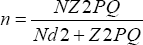
Where, n= sample size; N= population size (9,876); Z= reliability (95% or 1.960); P= proportion of population (0.5); Q= 1-P (0.5); d= maximum error (0.06); n= 270 households (sample size)
In allocating the sample size, n, among the different barangays, proportional allocation method was used. The allocation was computed as follows:


Where, nh= sample size for stratum; Nh= population size for stratum; N= population size; n= total sample size. The sample size per barangay was shown in Table 2. After determining the sample size per flood-prone barangay, simple random sampling was used to identify the respondents in each barangay. The respondents were chosen using the lottery method in which the names of each member of the population were written on a piece of paper that was then placed inside a box. The pieces of paper with the names written on each were randomly picked out from the box until the total sample size was reached.

Interview and Data Gathering
An interview guide was formulated to gather the primary data needed in the study. Pre-test was conducted for the interview guide. Site investigation of the study area and affected communities was conducted before the formal interview. Coordination and courtesy call with the LGU heads was also conducted to ensure the security and safety of the interviewers/ enumerators once they enter the different study sites.
Analytical Techniques
Socio-economic characteristics of the respondents: Data on the socio-economic characteristics of the respondents were tabulated and analyzed using descriptive statistics such as frequency, percentage, mean, standard deviation, Pearson correlation with the use of SPSS (Statistical Program for Social Sciences).
Physical Impacts of Flooding: The damages to farm house structures were analyzed using the Cost of Repair Method and Market Price Method. The damage to house contents was analyzed using Replacement Method and Costs of Repair Method. On the other hand, the damage to farm structures was analyzed using descriptive statistics. Costs of repair method was used to value the expenditure of the respondents in hiring or doing the repair to the physical damage to house structures and its contents.
Valuation of the Physical Impacts of Flooding
Farm Structures: The impacts of flood event on the farm structures like roads, bridges, dikes, irrigation canal were only discussed and described in terms of the condition that they were in due to the flood event.
Farm House Structures: The value of damage to farm house structures was computed as follows:

Where, Dfh= estimated damage to farm house structures; No= number of labor hired; Nd= number of days working; Wp= wage per day; Mc= estimated costs of new materials.
Farm House Contents: The damage to farm house contents was derived as follows:
Where, Dhc= Damage to house contents; Dv= Depreciated value of totally destroyed materials; P= Replacement costs of minor utensils; Cr= Costs of repair.
Results
Socio- Economic Characteristics of the Respondents
The study was composed of 270 respondents from selected ten barangays categorized as highly risks to flooding inKabacan, North Cotabato. It was randomly selected as representative of the population. Table 3 shows the socio-economic characteristics of the respondent in the study area.

Age of the Respondents: In terms of the ages of the respondents, the minimum age of the respondent was 21 years old and the maximum age was 82 years old with the mean age of 47 years old. Thus, majority of the respondent ages lies between 35 to 59 years old.
Gender, Civil Status and Household Size of the Respondents: Seventy seven percent (77%) of the respondents were male and the 33% were female. The study also revealed that majority of the respondents (92%) were married and the rest were single 4%, widower and separated 4% ( Table 3).The average household size was 5 individuals ( Table 3).
Years in Farming and Land Holdings: The minimum number of years in farming among the respondents was one year and a maximum of 63 years. The average year of farming among the respondents was 22 years with the average land holdings of 1.5 hectares ( Table 3). This implies that the farmers in the study area usually start farming at the age below 25 years old.
Educational Attainment: Majority of the respondents had attended and graduated in Elementary. Some respondents had attended and graduated in High school level and others reached and graduated in Tertiary level and some have no education at all. Thus, farming was the main source of livelihood among the respondents in which it does not requires high educational background. It also implied that the respondents who were affected by flood were those that have low in educational attainment. Further, a respondent who reached and graduated in college has other source of livelihood asides from farming like employment from different sector in the economy.
Tribe of the Respondents: Kabacan is made up of diverse cultural groups, each having distinct cultural values and practices. The biggest proportions of the total sampled respondents were Ilocanos (55%) who originated from Luzon, Northern part of the Philippines particularly at Ilocos Region. Ilocano was known as rice cultivator in the area since most of them were engaged in rice farming activities. The influx in this tribe in the municipality made the town more engaged in rice production asides from the favorable conditions of the area in which more suitable for rice production making the town the rice granary of the province. On the other hand, Muslim was the second largest tribe in the sampled population comprised of twenty two percent (22%). Muslim tribe includes Maguindanaon, Maranao and Yakan. Moreover, Ilonggo contributed 19% of the total sampled and the remaining were Cebuanos ( Table 3). The diversity of the tribes in the area made the town unique which comprised of different dialects.
Religion of the Respondents: Majority of the respondents were Protestant (40%), followed by Catholic (38%) and Islam believers (22%) ( Table 3). Protestant composed of different affiliations like Four Square, Aglipay, Alliance, Anchor Bay, Assembly of God, Church of Christ, Espiritista, Iglesia Filipiniana Independence, Iglesia in Cristo, Jehovah's Witness, Jesus Miracles, Methodist, Seventh Day Adventist, Wesleyan and among others. In relation to tribe, most of the respondents were non-Muslim.
Tenure Status of the Respondents: In terms of tenure status of the respondents ( Table 3), majority of the respondents were land owner (40%), followed by tenant/ leaseholders/ rent (31%) and maintainer comprised of (29%) of the total sampled respondents. The non- land owners like maintainers, leaseholders, rentals among others; agreements were made between them and to the land owner. The usual maintainer sharesin the area was 10- 12% shares of the total gross harvest with free 1 sack of milled rice at the start of land preparation.
Sources of Income of the Respondents: Majority of the respondents (99%) were engaged in farming as their main source of income and other respondents have other sources of income aside from farming ( Table 3). This results implied that majority of the respondents were dependent on agriculture as their source of employment. Other sources of income of the respondents are from employment in the government and private sector and engaging in small businesses.
Estimated Monthly Income of the Respondents: The estimated monthly income of most of the respondents ranged from Php 5001-10,000 which is 42% followed by those with income ranged from Php 5000 and below (35%), and the rest has an income above Php 10,001 a month ( Table 3). Since majority of the respondents have an income ranged from Php. 5001- Php. 10,000, this implies that most of the respondents have an income above the annual poverty threshold based on the annual per capita poverty threshold of the province in 2009 which was at Php. 15,486 (www.nscb.gov.ph).Their estimated average income a month was at Php 7,500 which provides them a total of Php90, 000annualincome. Since the average household size of the respondents is 5 persons, thus theirannual per capita income was Php 18,000. Therefore, most of the respondents (62%) have an income level deemed adequate in a particular year. These were the respondents that can afford minimal standard of living. Moreover, more than one third (35%) of the respondents had incomes below the poverty threshold level. They were those who hold unstable tenure status. They were the individuals who cannot afford the minimum standard of living.
Value of Physical Impacts of Flood
Damage to Farm Structures: During the flood event in the area, there were no records of severe damage to farm infrastructure like roads, bridges, irrigation canals and creeks. Some infrastructure like roads and bridges were not accessible during the flood event due to the overflow of flood waters. Based on the observation in the area, creeks and irrigation canals were slightly affected due to sedimentation and because of the speed and volume of flood waters.

Damage to Farm House Structures: The respondent's houses were usually located near the rice field areas. There were houses built with concrete or strong materials (49%) while 51% of the respondents had houses built using light materials (Figure 1). Concrete houses refer to the houses that were built using strong materials like hollow blocks, iron, steel and bricks and that have concrete floors and walls corrugated galvanized iron roofs. The non- concrete houses were those that were made from light materials like wood, nipa, bamboo and plywood with the roof made of salvaged materials, cogon, nipa and coconut leaves. The walls are also made of light materials like plywood and salvaged materials. Some respondents experienced house damage due to the flood while others were not affected by it. The houses that were affected by the floods were located beside or near the river, major creeks and canals, and those that were made of light materials. The affected houses were not totally damaged, instead there were only some portions or parts of the house that were affected by the flood. The value of the damage to farm houses is shown in the tables 4 & 5 below.


The part of farm house structures affected by the floods includes the walls, kitchens and flooring. These damages were acquired by the respondents whose houses were built of light materials. Some of the respondents who have non- concrete houses usually built their kitchen separate from the main house and made of light materials like bamboos and "nipa" in which it was vulnerable to flood waters. Moreover, the houses located near the river were almost carried by the flood waters resulting to trauma and insecurity among the respondents. The damaged portions of the houses were being repaired personally by the family members while others hired individuals to do the repair. As shown in table above, the total cost of new materials used to repair the houses amounted to Php65, 500 and the estimated cost of labor was Php 21,350. Thus, the total cost of damage to farm houses reached Php 88,850. Further, not all respondents acquired damage to their houses. The affected farmers were those houses that were built near to the major river and creek. The damage to house structures also depends on the velocity and volume of flood waters.
Tang [8] indicated that for residential area, both flood depth and duration are important factor contributing to flood damage. If depth and duration increases, flood damage will also increases. Further, concrete buildings are less susceptible to incur additional damage resulting from factor other than depth.
Thus, the damage to house structures varies with the location of the houses in which those houses located near the river and creeks was the one who usually acquired house structures damages. The detailed value of damage to farm house structures was shown in Table 6.

Damage to House Contents: Aside from the value of the damage to farm house structures, there was also damage to farm house contents due to flood event. The usual damage included in the costs of flood impacts to house contents were the damage to appliances, furniture and fixtures, and the cost of repair for the partially damaged materials. The table below shows the value of damage to farm house contents. The study revealed that the total costs of damage to furniture and fixtures and appliances reached to Php284, 816.68(see table above). The usual furniture and fixtures affected by flood waters were the divider, cabinet and sofa bed. Further, electric appliances were more prone to damage caused by flood waters. Moreover, the partially damaged appliances, furniture and fixtures were valued based on the costs of repair. The total costs of repair to the partially damage materials were amounted to Php13, 250. Thus, the total value of flood damage to house contents reached Php 298,066.68. The results revealed that the highest cost of damage to house contents were from the appliances which were more vulnerable and could easily be damaged by flood waters. Based on the Pearson correlation, the damage to house contents were positively related and associated with the flood height and negatively related with the type of the houses (Table 7). They were both statistically significant at 5% and 1% level of significance, respectively. This means that the higher the level of flood waters, the larger its impacts and damage to house contents. These will result to great loss and cost to the affected respondents.

When flood waters increased significantly, this will lead to dramatic increase in damage to house contents. Further, the type of the house was statistically related at 1% level of significance to the damage to house contents. It implied that the stronger the materials used during construction of the house, the lesser the damage to its contents since flood waters cannot easily penetrate the interior part of the house unlike the houses that were built of light materials that could easily be damaged by the flood waters. Moreover, damage to house contents differs because most of the respondents with concrete houses have more material possessions compared to respondents with nonconcrete houses which have lesser material things. Thus, the cost of damage between the two also differs. The higher the number of material possessions, the larger is the cost of damage while the lesser the number of belongings, the lower its costs acquired due to flood impacts. Further, damage of goods and properties inside the buildings were found to be the major components of flood damage that have greater impacts to the affected individual Tang [8].
Conclusion
Adding the cost of damage to farm house structures and its contents, it can be concluded that the estimated cost of the physical impacts of flooding in Kabacan, North Cotabato, Philippines amounted to P 386, 916.68.
Recommendations
Relocation and provision of low-cost and affordable housing units to the most vulnerable communities with low income especially to the farmers holding unstable status of ownership is recommended. Further, for the individuals who plan to build a house, the design should be environment friendly and should adapt to the environmental conditions of the area to make the structure stable against calamities such as floods. Moreover, government should formulate policies disallowing building in the flood prone areas. Meanwhile, government should develop a comprehensive plan on flood risk reduction and management and enhance/strengthen the preparedness system rather than focus on the response. Further, due to the extreme impacts of flooding in the area which is very costly to the farmers, the affected communities, as well as to the government, this should be instructive in terms of investments in addressing the flooding problem. Instead of spending money for the relief operation, the government should plan investments and seek projects that have long term benefits that could minimize and lessen the impacts of flooding. For future studies and to improve this research, valuation of flood protection projects, valuation of ecological and environmental services of rice farming system, valuation of psychological and emotional effects of flood impacts and assessment of sediment deposition in Pulangi River and Kabacan River are highly recommended. Moreover, data on the intensity of flood waters should be considered for future flood impact studies.
References
- Sanyal J, LU X (2004) Application to Remote Sensing in Flood Management with Spatial Reference to Monsoon Asia: A Review Natural Hazards 33: 283- 301.
- Foster J (2010) Floods in Bangladesh: A case study AS Geography AQA.
- Vozinaki AEK, Kourgialas NN, Karatzas GP (2012) Estimating Flood Inundation And The Consequent Economic Losses in The Koiliaris River Basin in Crete, Greece. Global Nest Journal 14(3): 284-293.
- James Foster (2010) Impacts of Floods.
- Williams W (2004) Magnitude and Frequency and the Flood Hazard.
- Benson C (1997) The economic impact of natural disasters in the Philippines. Overseas Development Institute, London, England.
- Asian Development Bank (ADB) (1994) Climate change in Asia Philippines country report: regional study on global environmental issues. Manila, Philippines.
- Tang CS (1992) Estimation of Flood Damage Cost for Bangkok. Water Resources Management 6: 47-56.


