


Climatic Variability and Degradation of the Banks of Mayo-Dorbo (South-West Chad)
Guirki A and Gouataine Seingué R*
Department of Geography, Higher Teacher’s Training College in N’Djamena, Chad
Submission: January 17, 2024; Published: January 31, 2024
*Corresponding author: Gouataine Seingué R, of Geography, Higher Teacher’s Training College in N’Djamena, Chad Email: heritier1986@hotmail.fr
How to cite this article: Guirki A, Gouataine Seingué R. Climatic Variability and Degradation of the Banks of Mayo-Dorbo (South-West Chad). Glob J Tourism Leisure & hosp manag. 2024; 1(2): 555557 DOI:10.19080/GJTLH.2024.01.555557.
Abstract
This article deals with climate variability and degradation of the banks of Mayo-Dorbo, a town located in the southwest of Chad. Degradation is one of the causes creating a socio-economic imbalance for farmers. The objective of this study is to assess the impact of climate variability and bank degradation in the Mayo Dorbo watershed. To carry out this study, the methodology is based on observations, field measurements, and questionnaires. The results show that the 1970s began with negative indices reflecting drought but from the 1990s, the rainfall situation improved with positive rainfall indices. According to field measurements in the dry season and in the rainy season, the degradation process is slow at the start of the rainy season with a decline of 44.5 cm, it reaches its optimum during the floods of the months (July and August) with a retreat on average by 120.5cm where precipitation is significant. The summary of measurements for the 2022 watershed season shows an average retreat of 130. 29cm along the banks. This decline is caused by the abundance of rains 79% soil to 13% and the relief to 8%.
Keywords: Climate variability; Bank degradation; Watershed; Mayo Dorbo; Vegetation
Introduction
In tropical Africa, perceptions and adaptation to climate variability remain a central question for farmers, researchers and decision-makers (Diallo, 2010; Ozer et al., 2013). Each year it causes various hazards whose intensity varies from one region to another. This situation is most often characterized by rainfall irregularities and a slight rise in temperature (9.7°C) which causes a succession of dry years with rainy years whose periodicity cannot be controlled (Bergonzini, 2004). These climatic hazards are perceived and experienced differently by vulnerable populations. The climate becomes restrictive for humans through its various factors (precipitation, relative humidity, temperature, etc.), thus causing serious effects on their health. The climate conditions the life of living beings, at the same time as it affects their survival. Indeed, variations in climatic parameters favor the proliferation of various types of vectors responsible for several pathologies (R. Gouataine and Y. Maimouna, 2019). Climate variability affects the landscape and agricultural activities across the world. The climate crises experienced by the Sahelian zones in the 1970s and 1980s had repercussions on the environment (Hountondji, 2008). The degradation of environmental resources is a phenomenon that particularly affects Sahelian countries, given the fragility of ecosystems. Knowing that the aggressive climate constitutes one of the factors of pressure on resources. Water erosion is therefore an environmental problem facing the world today. In Chad, the deterioration of riverbanks is observed along watercourses and generates a multitude of impacts which can be environmental, economic and social. Land degradation reduces the productive capacities of croplands, pastures and woodlands. This phenomenon is particularly worrying because it is observed along rivers, where land constitutes the main asset of rural populations. In search of agricultural space, the banks constitute an overexploited area because they form a set of islands essential for increasing yields. The objective of this article is to analyze the role of climate variability on the banks of the Mayo-Dorbo and the related adaptations.
Materials and Methods
ϖ The study area
The study area is in the south of Chad in the Mayo Kebbi-Ouest region. It is between 9°31’12.00’’ and 9°39’36.00’’ degree north latitude and 14°50’24.00’’ and 14°58’48.00’’’ longitude East (Figure 1). The Logone limits part of the study area to the west and forms the border with the Republic of Cameroon. This area is a sub-basin of the Mayo-Dallah. It is limited to the north by Tikem, to the south by Rong, to the west and east by Fama and Bougaroua.

Data and hardware
As part of the work, several data were used, namely climate data, precipitation, temperature, field data and socio-anthropology surveys.
The climatological data are those of the Pala station. These data range from 1980 to 2020. They provide information on the rainfall behavior of the study area and its probable impacts on bank degradation.
For field data, several measuring and experimental instruments were used in data collection. Eight (8) irons were used. These irons were cut into parts of 40 cm to be able to be used as a stake, 30 cm of which were buried in the grosssssund and the remaining 10 to allow measurement. For these measurements, the tape measure was used to measure the distance between the bank and on the major bed at 4m to put a stake and 25 m separates the different stakes. These stakes were installed with the same distances upstream of the mayo and downstream on the right bank and on the left bank and the same procedure for the tributary.
To evaluate the speed of evolution of degradation and to understand its dynamics, various measurements were first carried out. Each time it rains, measurements are taken on the bank to assess the surface loss. Measurements are made from the stake on the bank and note the quantity of earth carried away.
The sampling method used in this study is the simple random method. Questions on the exploitation of the space around the mayo, on the morphological dynamics and the perception of the population on the effects of degradation of the banks. To this end, the questions were asked to the head of the family (men or women) who had already spent 30 years there. In total, 90 households were surveyed.
Method
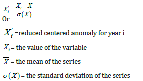
Interannual analysis of precipitation
From the standard deviation, the centered reduced interannual rainfall anomalies were calculated. The anomalies at each station are calculated as follows:
Calculating the standardized rainfall index makes it possible to determine the severity of drought according to different classes.
Climate Aggressiveness Index
The Fournier index or the climatic aggressiveness index allows us to know the erosive capacity of the climate. It is written as follows:

With p2: rain of the wettest month
P: annual rain
Socio-anthropological surveys
The actual analysis consisted of matching each question asked with an exact answer (given by the respondent), and previously codified. This work was done using SPSS software. The interface of this software simultaneously offers two windows, one of which concerns the display of variables, while the other is focused on data. We first had to fill in the “display of variables” sheet. The variables having already been identified, all that remained was to define the labels, values, and measurements that the software must consider during processing. Without minimizing the other structuring elements of the grid, we can say that it is at the level of values that the counting takes place. When this database is well put together, the “data display” window is the place to insert the codes corresponding to an answer given to each question asked. At the end we obtain a grid of figures, but which basically represents a synopsis of all the answers. By analyzing each column of the grid, we were able to highlight the different trends on each of the variables. It is based on all of the above and various processing that we have obtained all the statistics, graphs and tables appearing in this work.
Results and Discussion
Determination of climate in the Mayo Dorbo watershed

Analysis of the situation at the Pala station could help capture interannual variation (Figure 2). After the first wet decade with positive indices, the second began with negative indices testifying to the drought of the 1970s. Until the end of the 1980s, the drought continued with low and negative indices in certain years. But from the 1990s, the rainfall situation improved with positive rainfall indices except in 1997, 1999 and 2002 where the indices were negative. Overall, Pala station has moderate humidity. The average rainfall is around 1250 mm/year. They are unevenly distributed throughout the year with months with very little rain (April, May, June and October) and others with very little rain (June, July, August and September). These data are shown in Figure 3 below. According to field surveys carried out in the dry season and in the rainy season, the acceleration of the process of degradation of the banks of the Mayo Dorbo is a consequence of the difference in season. The process is slow at the start of the rainy season with a decline of 44.5 cm (field measurement) on agricultural land. However, it reaches its optimum during the floods of July and August with an average retreat of 120.5cm (field measurement) where precipitation is significant. The climate of the basin is tropical type located on the borders of dry tropical climates. It is one of the essential factors in the degradation of the banks of the Mayo Dorbo. The climate is Sudano-Sahelian with a rainy season which goes from April to October (07 months) and a dry season which extends from the end of October until May. This situation gives it particular temperatures and precipitation. Figure 4 highlights the peasant perception of climate change in Mayo Dorbo. The respondents affirm that the climate is perceived by 39% by the reduction of rains, 35% by the fluctuation of the temperature of which it is felt by the increase of the temperature in certain periods, the early drying up of water reservoirs and degradation of plant cover. The evolution of the climate can also be seen through the late arrival of rains with a rate of 16% and the early cessation of rains with 10% in the middle of an entire season.

Rain intensity as a factor in accelerating bank degradation
In Mayo Dorbo, a high intensity of rain has been recorded over the last decade, which is often accompanied by violent winds. When it falls on the banks, we notice a moment later, the banks begin to deteriorate. The action of the rains on the banks is observed through the raindrops. Because the latter constitute an important element of rain-fed soil degradation. They lead to mechanical decomposition of the aggregates and the formation of the mud crust which waterproofs the soil surface and increases runoff. Figure 4 above shows the factors. Figure 5 highlights the different factors which cause the degradation of the banks of the Mayo Dorbo watershed. According to observations, field surveys and measurements, the result shows 79% that the phenomenon of erosion of the banks of Mayo Dorbo is caused by the high intensity of rain, 13% shows that the phenomenon is due to the types of soil on the banks and finally 8% this is rather caused by the relief.
Bed widening
The current dimensions of the Dorbo mayo are not the same as those of previous years. Natural changes are visible as the years pass. This is because of the action of erosion on the banks of this watercourse. To carry out the aspect concerning the widening of the Mayo Dorbo, a comparison of the dimensions of the watercourse in width was necessary. To do this, maps were made according to a diachronic logic of the watershed at different scales. Namely that of the years 2002, 2012 and 2022. The measurements were compared with distances taken currently in 2022 on the watercourse. Regarding the measurements, the geographical coordinates of the points were first taken in the field. These points are denoted P1, P2, P3, P4, P5, P6, P7, P8 and P9. Each point represents a distance (retreat) between the right bank and the left bank. The following table presents the distances estimated in the field. Table 1 shows the measurements taken on the different points (section 1), in this section, the starting point is P2. In this table, we observe an increasing trend in the widening of the two banks on agricultural land. The measurements taken show that the bank is degrading more on the left bank than the right bank. This strong degradation on the left bank is due to the concave parts of the watercourse.
However, we note that at points P6, P7 and P9 on the left bank, there has been a strong deterioration because it is the concave part of the watercourse which receives the water at a high speed. On the right bank there is less damage since there are sediment deposits in this area, and this reduces the water pressure. The action of precipitation on the banks causes certain textural conditions and causes growth and degradation of the banks. A classification of rain each month with measurements of declines observed on the bank. Table 2 presents the results of field measurements on the bank downstream towards the outlet (Balani). In this table, the watercourse widens on the left bank more than the right bank. According to the measurements on the main course (Mayo- Dorbo), they were made on the secondary tributary courses of Mayo-Dorbo (Zéto). Table 3 presents the measurements taken on the banks of the tributary (Zéto) of the Mayo Dorbo. On the right bank at points P1, P3 and P4 we observe stability on the banks. But from point P5 to points P8 there is no stability, the banks only widen. Then on the left banks of the tributary from point P2 to point P8 the bank widens gradually.

Source: Field measurement, 2022.


Source: Field measurements, 2022.

Decrease in agricultural areas on the banks.
The search for new fertile and humid lands causes farmers to migrate to formerly unexploited areas. This migration is particularly remarkable in the Mayo Dorbo watershed were residents practice agriculture. But nowadays, the extension of the mayo favored by the erosion of the banks constitutes a great threat both for agricultural areas and for the plants cultivated on the banks. Farmers who have plots of arable land not far from the mayo see the surface area of their plots reduce each year. It is the same for Zéto mayo where in 2012 the field was 80m² and will be reduced to 68 m² currently in 2022. This reduction is due to the erosion that is occurring. In its production, it is often accompanied by numerous phenomena such as bank sliding, landslides, subsidence which causes significant loss of arable land (Figure 6). Figure 6 shows that the degradation of the banks of the mayo is at the origin of the regression in the surface area of an agricultural field. According to observations, surveys and field measurements, the owner of the field is concerned about the fact that in 15 years her field has retreated by around 10 m following the erosion of the banks.


Discussion
This research aims to study climate variability and degradation of the banks of Mayo-Dorbo. Observations, surveys and field measurements justify that the degradation of the banks of Mayo Dorbo is caused by anthropo-climatic and geomorphological factors. These factors allude to rainwater and anthropogenic factors which affect all human activities. According to analyzes carried out on the natural environment and land use, the aggressiveness of erosion is favored by the properties of certain soils. The impact of erosion on the morpho-hydrological evolution is also confirmed when we stick to observing the different parts of the banks along the section. The development of ravines and secondary channels. Bhkairi [1] who affirms that water erosion is manifested today by widespread gullying controlled, on the banks and in the plains, by suffusion. The determination of the different activities carried out on the banks during the two seasons certainly constitutes the factors responsible for the weakening of the banks have been identified and listed. And the results are confirmed by those obtained by Moussa et al., [2] and HUGUES (2015). Degrading vegetation located in the middle of a relief made up of plains and dotted with mountains. Having an anthropized bank subject to heavy agricultural exploitation is what has inevitably accelerated the phenomenon of bank erosion, while forming several sources of erosion along the section. This is highlighted by the work of Degoutte (2012) where water erosion of soils and riverbanks results from the interaction between static factors and dynamic factors. These static factors are linked to the vulnerability of the land (Annavai N, 2012). In this case the rainfall data was highlighted. But for greater reliability in the analysis, hydrological data would make it possible to understand the evolution of this phenomenon.
Conclusion
The results of Kana [3] indicate that the advances and retreats of the banks follow one another over time, depending on variations in hydrological parameters and the diversity of alluvial materials given the development of sources of erosion at the start and elsewhere. banks due to lack of vegetation [4-13]. The results obtained in this study are confirmed by those obtained in other geographical areas.
References
- Vodak J, Cakanova L, Pekar, M, Novysedlak M (2019) Influencer Marketing as a Modern Phenomenon in Reputation Management, Managing Global Transitions, University of Primorska, Faculty of Management Koper 17(3): 211-220.
- Terttunen A (2017) The influence of Instagram on consumers’ travel planning and destination choice (master thesis). University of Applied Sciences Haaga-Helia.Zivkovic et. al. (2014).
- García MDF, Daly AJ, Sánchez-Cabezudo SS (2016) Identifying the new Influences in the Internet Era: social media and Social Network Analysis 153: 23.
- Sheikhahmadi, Nematbakhsh A, Zareie (2017) Identification of influential users by neighbors in online social networks, Physica A: Statistical Mechanics and its Applications, Elsevier 486(C): 517-534.
- Audrezet A, Gwarlann K, Moulard J (2018) Authenticity under threat: When social media influencers need to go beyond self-presentation. J Business Res 117: 557-569.
- Chapple C, Cownie F (2017) An investigation into viewers’ trust in and response towards disclosed paid-for endorsements by YouTube lifestyle Vloggers. J Promotional Communi 5(2).
- Magno F, Cassia, Cassia F (2018) The impact of social media influencers in tourism. Anatolia 29(2): 288-290.
- Hvass K, Munar A (2012) The takeoff of social media in tourism. J Vacation Market 18(2): 93-103.
- Alizadeh A, Isa RM (2015) The use of social media in destination marketing: An exploratory study. Tourism: An Int Interdisciplinary J 63(2): 175-192.
- Cox C (2009) The Role of User-Generated Content in Tourists' Travel Planning Behaviour. J Hospital Market Manage 18(8): 743-764.
- Varkaris E, Neuhofer B (2017) The influence of social media on the consumers’ hotel decision journey. Journal of Hospitality and Tourism Technology 8(1): 101-118.
- Santiago J, Castelo I (2020) Digital influencers: An exploratory study of influencer marketing campaign process on Instagram. Onl J Appl Knowledge Manage p. 31-53.
- Zeng B (2013) Social media in Tourism. J Tourism Hospitality 2(1).
- John S, Larke R, Kilgour M (2018) Applications of social media for medical tourism marketing: an empirical analysis. Anatolia Int J Tourism Hospitality Res 29(4): 553-565.
- Hu L, Min Q, Han S, Liu Z (2020) Understanding followers’ stickiness to digital influencers: The effect of psychological responses. Int J Info Manage 54: 1-14.
- Ketrin SN, Szilárd A (2020) Consumer Decision Making in Influencer Marketing. Annals of the University of Oradea. Economic Sci Series 29(2): 326-336.
- Xu Xu (Rinka), Stephen P (2018) Social media influencers as endorsers to promote travel destinations: an application of self-congruence theory to the Chinese Generation Y. J Travel Tourism Marketing 35(7): 958-972.
- Breakenridge DK (2012) Social media and public relations: Eight new practices for the PR professional. Upper Saddle River, NJ: Pearson Education.
- Rinka X, Pratt S (2018) Social media influencers as endorsers to promote travel destinations: an application of self- congruence theory to the Chinese Generation Y. Journal of Travel and Tourism Marketing 35(7): 958-972.
- Dabija DC, Postelnicu C, Dinu V (2018) Cross-Generational Analysis of Ethics and Sustainability. Insights from Romanian Retailing. In: Idowu SO, Sitnikov C, Simion D, Bocean C (eds.), Current Issues in Corporate Social Responsibility. Thur, Springer International Publishing, pp.141-163.
- Fotis J, Buhalis D, Rossides N (2012) Social media use and impact during the holiday travel planning process. Information and Communication Technologies in Tourism p. 13-24.
- Hudson S, Thal K (2013) The Impact of social media on the Consumer Decision Process: Implications for Tourism Marketing. J Travel Tourism Market 30(1): 156-160.
- Lu W, Stepchenkova S (2015) Ecotourism experiences reported online: Classification of satisfaction attributes. Tourism Manag 33(3): 702-712.
- Dandison CU, Heikki K (2018) What drives travelers' adoption of user generated content? A literature review. Tourism Management Perspectives 28: 251-273.
- McKnight DH, Chervany NL (2002) What trust means in e-commerce customer relationships: An interdisciplinary conceptual typology. International Journal Electronic Commerce 6(2) 35-59.
- Dellarocas CN, Neveen FA, Zhang X (2007) Exploring the Value of Online Product Reviews in Forecasting Sales: The Case of Motion Pictures. J Interactive Market 21(4): 23-45.
- Lee WH, Lin CW, Shih KH (2018) A technology acceptance model for the perceptionof restaurant service robots for trust, interactivity, and output quality. Int J Mobile Communic 16(4): 361-376.
- Chung N, Han H, Joun Y (2015) Tourists’ intention to visit a destination: The role of augmented reality (AR) application for a heritage site. Comput Human Behav 50: 588-599.
- Bernard H (2000) Social Research Methods: Qualitative and Quantitative Approaches, Sage, Thousand Oaks, California.
- DeVellis RF (2003) Scale Development: Theory and Applications, Thousand Oaks - CA, Sage.
- Gay LR, Airasian P (2000) Educational research: Competences for analysis and application, Upper Saddle River – NJ, Merrill–Prentice Hall, Upper Saddle River.
- Marôco J (2011) Análise estatística com o SPSS Statistics (5th edn.) Pêro Pinheiro, Portugal: Report Number.
- Goldsmith RE, Clark RA (2008) An analysis of factors affecting fashion opinion leadership and fashion opinion seeking. J Fashion Marketing Manage 12(3): 308- 322.
- Chetthamrongchai P (2017) The Influence of Travel Motivation, Information Sources and Tourism Crisis on Tourists’ Destination Image. Journal of Tourism Hospitality 6: 278.
- Kotler P, Kartajaya H, Setiawa I (2017) Mudança do tradicional para o digital: Marketing 4.0. Coimbra: Actual 14(27).
- Rihova I, Buhalis D, Moital M, Gouthro MB (2013) Social Layers of customer-to-customer value co-creation, J Service Manage 24(5): 553-566.


