


Pasture Modelling in Mountain Areas: the Case of Italian Alps, and Pakistani Karakoram
D Bocchiola1'2* and A Soncini1
1EVK2-CNR Association, San Bernardino 145, Italy
2Department of Civil and Environmental Engineering, Politecnico di Milano, Italy
Submission: June 30, 2017; Published: July 18, 2017
*Corresponding author: D Bocchiola, Department of Civil and Environmental Engineering, Politecnico di Milano, L. Da Vinci, 32, 20133, Milano, Italy, Email: daniele.bocchiola@polimi.it
How to cite this article: D Bocchiola, A Soncini. Pasture Modelling in Mountain Areas: the Case of Italian Alps, and Pakistani Karakoram. Agri Res & Tech: Open Access J. 2017; 8(3): 555736. DOI: 10.19080/ARTOAJ.2017.08.555736
Abstract
We employ here a recently developed hydrologically based, spatially distributed pasture yield model Poly-Pasture for the purpose of modeling pasture dynamics in mountain environment. We propose two test cases in high altitude areas, namely in the Alps of Italy (Valtellina valley), and in the Pakistani Karakoram (Central Karakoram National Park CKNP). The model is driven by daily data of temperature, precipitation, and solar radiation, and provides in output estimates of soil moisture, runoff, and pasture, in terms of LAI, and biomass. We simulate pasture grass growth for our two study areas (Alps, 2002-2007, Karakoram, 1997-2011), and we compare yearly indexes of biomass yield against ground based and satellite based estimates (Alps), and estimates from literature (Karakoram), displaying acceptable model performance. We then comment about pasture yield patterns and variability depending on the area. Our pasture models provide acceptable performance in depicting daily, spatially distributed dynamics of pasture grass in the mountains, within two geographically very different areas as chosen here. Our model is therefore useful when tackling a number of issues, including e.g. i) assessment of pasture (and fodder) productivity under present climate and management, ii) seasonal forecast of pasture yield for herding, and iii) projection of pasture conditions under climate change as projected by climate models. Future development may concern assessment of nutrient dynamics, and the effects of (over)grazing on pasture.
Keywords: Pasture; Crop models; Climate; Alps; Karakoram; Remote sensing
Introduction
Pastures and grasslands cover ca. 50 million km2 worldwide and 20% of lands, support most of the three billion ruminants and represent with forests a main carbon storage worldwide [1,2]. Grasslands are mostly located in steep, and often semiarid areas, little suitable for agriculture. Interest on pastures particularly focuses upon the effects of (over) grazing [3], that may potentially change soil properties, and pasture patterns [4], and prevents natural renovation of forests reducing soil fertility. Assessment biomass and nutritional quality of forage is thus essential, because they influence grazing patterns of livestock [5], and affect animal performance [6,7]. Pasture yield could have in turn implications on land use planning and local policy making (e.g. subsidies, mitigation of drought crises, etc.), particularly in the Mediterranean areas [8,9]. Dynamics of pastures are important for sustainable breeding of livestock worldwide [8,10-13], including Italy [14,15]. Pasture growth is linked to climate, and global warming conditions may result into modified (worse?) pasture conditions, especially as an outcome of extreme events [13,16]. As such, one needs to develop modeling tools, able to accurately mimic pasture production under specific climate conditions [14], and water availability [2,17], that can be later used to accurately mimic pasture production under specific climate conditions [14], and water availability [2,17], that can be later used to evaluate potential for pasture production, and assess potential effect of climate variations (Tubiello et al. [16], for a review of potential effect of climate change upon crops, and pastures).
Poly-Pasture is based upon the inclusion of a pasture- growth module within a spatially distributed hydrological model already developed and used by the authors [20,21] to mimic the joint dynamics of water budget and runoff production within hydrological catchments, and pasture (and crop) production upon vegetated or cultivated areas therein. The PolyPasture module has been already used and validated, also in spatially distributed mode, to mimic pasture (and, with proper modifications crops) productivity [22-24]. The model is driven by daily data of temperature, precipitation, and solar radiation, and provides in output estimates of soil moisture, runoff, and pasture, in terms of LAI, and biomass.
We simulate pasture grass growth for our two study areas (Alta Valtellina valley, in the Italian Alps, 2002-2007, and the Central Karakoram National Park CKNP, 1980-2011), and we compare yearly indexes of biomass yield against ground based (2002-2004), and satellite based (2005-2007) estimates (Alps), and estimates from literature (Karakoram), displaying acceptable model performance. We then comment about pasture yield patterns and variability depending on the area, and upon future evolution of our research.
Case study areas

Central Karakoram National Park: Northern areas (i.e. Gilgit - Baltistan) covers Northern Pakistan (Figure 1a), bordered by Afghanistan at North and West, with China in the North and East and India in South-East. Extension of the area is nearby 73000km2, with four mountain chains converging in the area, Himalaya, Karakoram, Hindu kush, Pamir, including some world highest peaks, e.g. (K2, 8611m a.s.l.). Climate of the region is of cold desert type (BWK), i.e. a dry climate with little precipitation and large daily temperature range [25]. Some studies indicate a total annual rainfall between 200mm and 500mm below 2000m a.s.l. or so. Recent estimates Soncini et al. 2015 indicate from 6 to 8 meters of snow depth (ca. 3m snow water equivalent, SWE) at 5000m a.sl. or so, and rapidly decreasing there above (Immerzeel et al. 2012). Accordingly, snow and ice melt at the highest altitudes contribute largely to irrigation in the lowest areas [26]. Cultivable lands here cover an altitude belt around 1200m a.s.l., generally irrigated given little precipitation as reported. Most of the Northern Areas fall within the Central Karakoram National Park (CKNP), covering more than 10000km2. The Park includes ca. 230 villages, and ca. 100000 inhabitants, of which 90% relies on subsistence breeding. Tourism, and logging for fire heating constitute other pillars of local economy. Rangelands cover ca. 23% of the Park, given high altitude (with mean altitude 4613m a.s.l., and 35% of the area above 5000m a.s.l.), complex topography, and large cryospheric cover In Askole (3015m a.s.l.) temperature in winter averages -5 °C (and reach -15 °C), while in summer it averages 20 °C (peaking at 30 °C). Vegetation distribution is limited by low temperature above 4500m a.s.l., and little precipitation below 2000m a.s.l. Livestock farming plays an important role in the economy of CKNP, and in the region's food security due to its contribution to the production of milk, meat, farmyard manure, wool and draft Hofmann et al. 1998 [27]. In 2002 the animal population was estimated to exceed two million animals with a prevalence of poultry and goats (NASSD, 2002). Most of the households (80-90%) are reported to have adopted the transhumant system of animal husbandry. During the winter livestock are kept in the village, fed with hay and straw. In the Summer months the animals are taken up into the mountains to graze on the sub-alpine (2000-3000m a.s.l.) and alpine pastures (above 3000m a.s.l.). Goats, sheep and lactating animals are closed in pens every evening for milking and safety purposes, while non lactating cows, zomos, and other draught animals are left grazing freely. With the first snow falls they move back to the lower pasture and then to the village in late September/October. Because of small landholding and availability of water, pastures are generally overgrazed, especially the ones near water sources. Overgrazing reduces the productivity level and biodiversity of the land and accelerate erosion and degradation. It also reduces palatable plant leaf areas, which reduces interception of sunlight and plant growth, so that plants become weakened and are replaced by unpalatable species. Overgrazing affects adversely also livestock performance and body condition. It is therefore necessary to explore mechanisms to reduce livestock grazing pressure on pastures. This requires understanding of the pasture productivity by estimating the potential and actual biomass accumulation. It would be therefore possible to evaluate bearing capacity of pastures, and in general which management practices can be adopted in the area. Within the CKNP we studied pasture yield in 2 villages, namely Astore (2200m a.s.l.), where former studies provided some estimates of potential biomass, and we could run a simulation during 2004-2007, and Askole (3015m a.s.l.), where long term (1997-2011) simulation could be pursued.
Alta valtellina valley: Alta Valtellina (AV) valley is in the North-East of Lombardia region of Italy (Figure 1b), and belongs to pasture lands of central Alps [19]. Climate is continental with cold summer and no dry season, and polar tundra at the highest altitudes [25]. Rainfall regime displays winter minima, and peaks in June/July and September/October, with an annual average of ca. 730mmy-1. Temperature is cold, with annual average of 7.5 °C in Bormio (1300m a.s.l.), reaching 1.9 °C at 1900m a.sl. (lago Cancano) and -0.5 °C at 2600m a.s.l. (Livigno). Vegetation is typical of Alpine environment, with coniferous forests, and shrubs in the boreal belt until 2000m a.s.l. or so, and prairies and pastures at the highest altitudes. Pastures derive therein from logging of forests, in response to increase of herding in the area. Pastures in Alta Valtellina valley cover a surface nearby 11.000ha (of 90.000 ha total surface). Active pasture lands during 80-90 days a year host ca. 3400 cows, 1500 sheeps/goats, and some hundreds pigs, and horses [28]. Breeding strategies includes free, controlled, and rotation pastures. Low altitude pastures (1600-1800m a.s.l.) are used starting from June, while higher areas (above 2500m a.s.l.) are used starting from August. Manuring occurs naturally from animal wastes, with no chemical compounds used [19]. We studied here an area covering ca. 500km2 South-West of Bormio town, where former studies provided estimated biomass for comparison, and satellite based LAI estimation also allowed a comparison.
Database
Meteorological data: Meteorological data required are used here daily series of precipitation, maximum and minimum temperature, solar radiation. In Pakistan, temperature and precipitation data were provided by Pakistani Meteorological Department PMD in the form of monthly values of mean temperatures/precipitation in eight stations below 2500m a.s.l. These were downscaled to daily values (mean, min, max temperature, mean daily temperature) based upon data from two meteo stations belonging to EVK2CNR association (Askole, 3015m a.s.l., Urdukas, 3926m a.s.l.), delivering temperature and precipitation at 15 minute resolution during 2005-2008 [21]. Global radiation is calculated daily from thermal excursion (T max-Tmin) and extraterrestrial radiation, using FAO approach (Allen et ill. 1998).
In Alta Valtellina valley, ARPA (Regional Environmental Protection Agency) provided meteorological data (temperature, precipitation, global radiation and snow depth) during 20022010 in 5 stations. Monthly values of lapse rates for temperature and precipitation were assessed to account for vertical variability, and Thiessen polygons were used for area of influence of precipitation stations.
Soil parameters: Other than the latitude and elevation of the referring meteorological stations and the average height of the cells, the PP model requires, for every cell, the hydraulic properties of soil. These properties, namely wilting point θw, field capacity θp saturation θs, hydraulic conductivity K, were obtained here starting from soil texture (Saxton, 1986), while depth of the soil layer was assigned as per each cell.

In the CKNP a soil texture map was derived from Eus DAM (Panagos et al. 2011) Digital European Archive of Soil Maps, reporting Northern Areas soil as loamy. For Alta Valtellina, texture class has been obtained from JRC’s European texture map [29], giving mainly loam and sandy-loam substrate. Table 1 reports soil parameters for the case study areas calculated accordingly.
Vegetation parameters: The PP model then requires some agronomic parameters, concerning the phenology of pasture, in analogy with crop models [14,30-33]. These parameters and their chosen values are summarized in Table 2, together with their unit of measurement and range of values. While for crops and agricultural species numerous studies exist, providing the evaluation of base and optimal temperatures [34], for wild
grasses these parameters are less largely available. Also, as reported pasture is classified here as a mixture of different species, so that average values were retrieved and used in the present work [15,33-35].

For Alta Valtellina valley however we had available information concerning two specific genotypes, Deschampsia caespitose Poa alpine (Deschampsia), and Nardus stricta Carex sempervirens (Nardus), Boschetti et al. [19], and phenologic parameters were taken accordingly (Table 2). For CKNP, given the lack of information concerning pasture productivity and timing in the area we used the same thermal times as adopted within a former study Addimando et al. [23] covering pasture productivity in Sardinia region, displaying similar climate settings, with scarce precipitation, and hot temperatures during summer.
LAI satellite maps: For Alta Valtellina valley, we couldobtain LAI satellite maps during 2005-2007, as provided by Zhu et al.[36]starting from AVHRR NDVI3g data, available at the NASA Earth Exchange web site. These data contain level 3 information [37],and are already processed to remove cloud disturbance. These data are gridded at a 1/12 degree spatial resolution, and are available with a 15 days temporal frequency, and were used to validate LAI (and indirectly biomass) as simulated by PP models as in Addimando et al. [23].
Biomass data: In a former study by Boschetti et al. [19] the authors gathered biomass data for different species composing pastures in the Parco dello Stelvio area, nearby our case study area in Alta Valtellina, during July-August 2002-2004. Given sufficient data availability we decided to use data for the two species Deschampsia caespitose Poa alpina, and Nardus stricta Carex sempervirens. These data were used for assessment of PP model's results. For CKNP we could find a former report byWWF- EVK2CNR (2011), quantifying (mean, unknown reference period) pasture productivity within the district of Astore (2200m a.s.l.), which we could use for a rough comparison.
Methods
Poly-Pasture model
We used here the semi-distributed Poly-Pasture PP model, obtained by including a vegetation growth module coupled to a spatially distributed hydrological model already developed and used by the Politecnico di Milano staff. The vegetation growth model mimics simple crop growth models such as Cropsyst[38] . The hydrological model uses a water budget scheme to provide soil water content, then fed to the vegetation module. Vegetation growth module provides in turn LAI, used by the hydrological model to calculate the transpiration, and fraction of vegetated soil, and updated soil water content. Both modules work at a daily scale upon a grid. Each cell in the grid has its own topography, vegetation, meteorological input variables and soil properties. Every cell is considered independent from the others, so neglecting lateral flows. Such approximation is valid for large cells, and flat areas, with little lateral redistribution, as in our case study areas. One soil layer is considered given the limited root depth of pasture grasses. The hydrological model builds upon a simplified water budget equation to calculate soil moisture a two subsequent time steps (t, t + Δt)

With S soil water content, P rainfall, Mssnow melting when applicable, ET is real evapotranspiration, Qg groundwater discharge, and Qs overland superficial flow, all in mm. The growth model provides biomass by taking the minimum between water dependent, and radiation dependent growth

with GTR [kgm"2day1] transpiration dependent growth, Teff [mday-1] effective transpiration, VPD [kPa] vapor pressure deficit, BTR [kPakgm-3] biomass transpiration, GR [kgm"2day-1] radiation dependent growth, Ltbc [kgMJ-1] light to biomass conversion, PAR [MJm"2day"1] photosyntetically active radiation, fPAR [.] fraction of PAR intercepted by canopy, and Tlim temperature limitation factor [.].
It is assumed full availability of soil nutrients. Generally pastures, albeit subject in some cases to natural fertilizing through animal disposal, do not generally undergo fertilization (or irrigation). Biomass estimates are “potential” in this sense. Vegetation growth stages are based on the accumulation of thermal time (or degree days) during the growth season. Every species reaches the next growth stage when the necessary thermal time has been cumulated. Below a base temperature the thermal time is not cumulated [38]. In the presence of vegetation biomass, the evapotranspiration depends upon the LAI, which is iteratively calculated for each day of the simulation. The effectivetranspiration depends upon the daily vegetation growth, and its vegetative stage [39], as
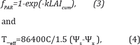
With k [.]extinction coefficient for solar radiation, C [kgsm- 4] root conductance, Ψs soil water potential [Jkg-1],Ψx [Jkg-1] leaf water potential, 86400 number of seconds per day, and 1.5 conversion factor of root to hydraulic conductance.
Cells size and influence area
In the CKNP, PP model was run in point wise mode, for Askole (1997-2011), and Astore (2005-2008) separately. In Alta Valtellina valley PP model was run in distribute mode, and cells' size was taken using the resolution of the satellite maps to be used for comparison. Namely, we used 6 square cells of 1/12 degree (9.3km) size. Such low spatial resolution reduces computation burden, and allows to compare directly the model simulated LAI maps against those from remote
Results
CKNP

In Figure 2 it is reported the estimated crop yield in Astore during 2005-2008. According to Pakistan habit, we hypothesized an irrigation of 250mm during the growing season, so no water limitation occurs. An average value is obtained of 1.6 ton ha-1 A study by WWF-EVK2CNR (2011), based on Bari (2002) shows that the estimated potential productivity of pastures is 1.6ton ha-1 for Astore, 1.20ton ha-1 for Skardu 60km East of Astore, 1.4ton ha-1 for Gojal further North. Actual surveys showed an effective productivity of 0.43ton ha-1 in Astore,0.41ton ha-1 in Gojal, and 0.24 tonha-1 for Skardu, possibly doubling when considering already consumed forage (May to August). In Figure 2 were port potential production in Askole (3015m a.s.l.) during 1980-2011. Visibly, given the high altitude of this site,large variability is observed around the average value (E [YP] = 0.69 tonha-1, CV[YP] = 0.43), in response to minimum daily temperature in the year.
This is clearly visible e.g. in year 2005, when particularly low temperatures decreased largely potential pasture yield in Askole, with yield Astore (lower, and therefore warmer) still acceptable.
Alta Valtellina

In Figure 3, we report the simulated pasture yield (dry biomass) in AV case, for Deschampsia, and Nardusin those years when samples of biomass were gathered [19]. We report maximum daily values of biomass (i.e.potential yield at harvesting, consistently with modeling hypothesis), normally occurring at the end of July. For Deschampsia one has E[YP]D = 3.36 ton ha-1, and 3.28ton ha-1, for observed, and simulated values respectively. For Nardus, E[YP]N = 1.25 ton ha-1, and1.17ton ha-1, respectively, with some visible disagreement in year 2002.

In Figure 4, we report a comparison between spatially averaged values of Leaf Area Index LAI from PP model, and corresponding estimates from satellite for years 2005-2007. We considered averaged values of modelled LAI for Deschampsia and Nardus, and to filter noise from other species on the ground we compared LAIonly during growth season of the modeled species. LAI at peak was E[LAI] = 1.63m2m-2, and 1.60 m2m-2, for observed, and simulated values respectively.
Discussion and Conclusion
Our PP model seems substantially capable of capturing pasture productivity as depending on local geographic settings, and climate variability. In the Pakistani application here, paucity of information concerning pasture productivity, especially in the high altitudes prevents from pursuing accurate validation. However, comparison with sparse literature data of potential production provides acceptable fitting. Also, the PP model is clearly able to capture pasture yield dependency upon year to year weather variability. Comparison between daily values of YP in Askole and Astore (not shown) illustrates the differences in growth season length (from half June to half September in the first site, from half May to half September in the second one), and yield (Figure 2), in response to lower temperature in the first, higher site. Accordingly, comparison of pasture yield between different sites with largely variable altitude is difficult. However, PP model can aid pasture assessment, given that it explicitly account for thermal, and precipitation regime in each specific site. Also, preliminary simulation in the CKNP (not shown) demonstrated that no pasture growth was practically feasible for the study sites under rain fed conditions, given the low precipitation. Accordingly, irrigation was taken as per the necessary amount to reasonably fulfill evapotranspiration requirements. This is reasonable given the circumstance that in the considered area large irrigation is provided for all purposes, including agriculture, and fodder production. Within the Alpine site, much larger precipitation is available, and pasture grows under rain fed conditions. Also, more information is available, including in situ sampling of pasture productivity, and satellite estimation of LAI. Such circumstance allowed to validate properly PP performance, acceptable according to our results as reported, both in term of biomass, and LAI.
The PP model makes a number of simplifying assumptions, and future developments of the model may include especially i) study of nutrients' cycle dynamics, and assessment of the effects of nutrients' budget (including manuring, and over-grazing), and ii) validation of evapotranspiration estimates [40-43].
Our results clearly demonstrate how the proposed PP model, simple as it still allows to investigate explicitly
- Dependence of pasture yield on topography, soil properties, and seasonal weather in complex mountainous terrains.
- Necessary water requirement for irrigation of pasture in dry conditions.
Besides pasture variability in the mountains under present climate, transient climate change as projected for the future can impact pasture productivity within sensitive areas, and investigation of prospective evolution of pastures under climate change is required.
Our PP model represents an optimal tool for doing so, and will be applied in the forthcoming.
References
- Lale NES (2002) Stored Products Entomology and Acarology. In: Scott NA, Tate KR, Robertson JF, Giltrap DJ (1999) Soil carbon storage in plantation forests and pastures: land-use change implications. Tellus 51(2): 326-335.
- da Silva JE, Resck DVS, Corazza EJ, Vivaldi L (2004) Carbon storage in clayey Oxisol cultivated pastures in the Cerrado region, Brazil. Agriculture, Ecosystems and Environment 103: 357-363.
- Senft RL, Rittenhouse LR, Woodmansee RG (1984) Factors influencing patterns of cattle grazing behaviour on short grass steppe. J Range Manage 38(1): 82-87.
- Fiedler FR, Frasier GW, Ramirez JA, Ahuja LR (2002) Hydrologic Response of Grasslands: Effects of Grazing, Interactive Infiltration, and Scale. J Hydrol Eng 7(4): 293-301.
- Bailey DW, Gross JE, Laca EA, Rittenhouse LR, Coughenour MB, et al. (1996) Mechanisms that result in large herbivore grazing distribution patterns. J Range Manage 49(5): 386-400.
- Ball D, Collins M, Lacefield G, Martin N, Mertens D, et al. (2001) Understanding Forage Quality”. American Farm Bureau Federation Publication 1-01. American Farm Bureau Federation, Park Ridge, Lllinios.
- Hunt ER, Everitt JH, Ritchie JC, Moran MS, Booth DT, et al. (2003) Applications and research using remote sensing for rangeland management. Photogramm Eng Remote Sens 69(6): 675-693.
- Badini O, Stöckle C, Jones JW, Nelson R, Kodio A, et al. (2007) A simulation-based analysis of productivity and soil carbon in response to time-controlled rotational grazing in the West African Sahel region. Agricultural Systems 94: 87-96.
- Fava F, Colombo R, Bocchi S, Meroni M, Sitzia M, et al. (2009) Identification of hyperspectral vegetation indices for Mediterranean pasture characterization. International Journal of Applied Earth Observation and Geo information 11(4): 233-243.
- Liu H, Cai X, Geng L, Zhong H (2005) Restoration of Pasture land Ecosystems: Case Study of Western Inner Mongolia. J Water Resour Plann Manage ASCE 131(6): 420-430.
- Numata I, Roberts DA, Chadwick OA, Schimel J, Sampaio FR, et al. (2007) Characterization of pasture biophysical properties and the impact of grazing intensity using remotely sensed data. Remote Sensing of Environment 109: 314-327.
- Hussain A, Farooq MA, Ahmad M, Akbar M, Zafar MU (2010) Phytosociology and Structure of Central Karakoram National Park (CKNP) of Northern Areas of Pakistan. World Applied Sciences Journal 9 (12): 1443-1449.
- Cullen BR, Johnson IR, Eckard RJ, Lodge GM, Walker RG, et al. (2009) Climate change effects on pasture systems in south-eastern Australia. Crop and Pasture Science 60(10): 933-942.
- Confalonieri R, Acutis M, Bellocchi G, Donatelli M (2009) Multi-metric evaluation of the models WARM, Crop Syst, and WOFOST for rice. Ecol Model 220(11): 1395-1410.
- Colombo R, Zucca C, Bocchi S (2009) Caratterizzazione dei pascoli mediante tecniche di telerilevamento” [Pasture Characterization via remote sensing techniques. In: Soster M, Aceto P (Eds.), La gestione sostenibile dei sistemi pascolivi italiani. Progetto Maso-GIS. Italy, pp.25-54.
- Tubiello FN, Soussana JF, Howden SM (2007) Crop and pasture response to climate change. PNAS 104(50): 19686-19690.
- Snyder RL, Spano D, Duce P, Paw KT, Rivera M (2008) Surface Renewal Estimation of Pasture Evapotranspiration. J Irrig Drain Eng 134(6): 716-721.
- Gianelle D, Vescovo L (2007) Determination of green herbage ratio in grasslands using spectral reflectance. Methods and ground measurements. International Journal of Remote Sensing 28(5): 931-942.
- Boschetti M, Bocchi S, Brivio A (2007) Assessment of pasture production in the Italian Alps using spectrometric and remote sensing information. Agriculture, Ecosystems and Environment 118(1-4): 267-272.
- Groppelli B, Soncini A, Bocchiola D, Rosso R (2011) Evaluation of future hydrological cycle under climate change scenarios in a mesoscale Alpine watershed of Italy. Nat Hazards Earth Syst Sci 11: 1769-1785.
- Bocchiola D, Diolaiuti G, Soncini A, Mihalcea C, D'Agata C, et al. (2011) Prediction of future hydrological regimes in poorly gauged high altitude basins: the case study of the upper Indus, Pakistan. Hydrol Earth Syst Sci 15(7): 2059-2075.
- Nana E, Soncini A, Confortola G, Bocchiola D (2013) Climate change related hazard for maize cropping in the Po valley of Italy. Geophysical Research Abstracts 15: EGU2013-7979.
- Addimando N, Nana E, Bocchiola D (2015) Modelling pasture dynamics in a Mediterranean environment: a case study in Sardinia. ASCE Journal of Irrigation and Drainage Engineering 141(5).
- Bocchiola D, Nana E, Soncini A (2013) Impact of climate change scenarios on crop yield and water footprint of maize in the Po valley of Italy. Agricultural Water Management 116: 50-61.
- Peel MC, Finlayson BL, McMahon TA (2007) Updated world map of the Koppen-Geiger climate classification. Hydrology and Earth System Sciences 11(5): 1633-1644.
- Bari F (2002) Mountain Areas Conservancy Project: Biomass Survey Report. PAK/98/G31. p. 70.
- Husain T, Hussain A, Ahmed M (2009) Studies of vegetative behavior and climatic effects on some pasture grasses growing wild in Pakistan. Pak J Bot 41(5): 2379-2386.
- Gusmeroli F, Della Marianna G, Arosio G, Pozzoli L (2005) I pascoli dell'Alta Valtellina. Presentazione di una trilogia. Pastures in high Valtellina: Presenting a Trilogy.
- Hiederer R (2012) EFSA Spatial Data Version 1.1 Data Properties and Processing. Publications Office of the European Union, Europe.
- Moreira MZ, Sternberg LdSL, Nepstad DC (2000) Vertical patterns of soil water uptake by plants in a primary forest and an abandoned pasture in the eastern Amazon: an isotopic approach. Plant and Soil 222: 95-107.
- Stöckle CO, Donatelli M, Nelson R (2003) Crop Syst, a cropping systems simulation model. European Journal of Agronomy 18(3-4): 289-307.
- Lacovara B (2006) La valutazione dello stress idrico vegetazionale come strumento di pianificazione agricola nella lotta alla desertificazione. Estimation of water stress on vegetation as a tool for agricultural planning in the fight against desertification, Italy
- Gusmeroli F (2012) Prati, pascoli e paesaggio alpino meadows, pastures and Alpine landscape. Edizioni SoZooAlp. Trento, Italy
- Angus JF, Cunningham RB, Moncur MW, Mackenzie DH (1981) Phasic development in field crops. I. Thermal response in the seedling phase. Field Crops Res 3(4): 365-378.
- Cervelli C (2005) Le specie arbustive della macchia mediterranea shrubs in the mediterranean Area. In Italian Sicilia Foreste 26.
- Zhu Z, Bi J, Pan Y, Ganguly S, Anav A, et al. (2013) Global Data Sets of Vegetation Leaf Area Index (LAI)3g and Fraction of Photosynthetical- ly Active Radiation (FPAR)3g Derived from Global Inventory Modeling and Mapping Studies (GIMMS) Normalized Difference Vegetation Index (NDVI3g) for the Period 1981-2011. Remote Sensing 5(2): 927-948.
- Hagolle O, Lobo A, Maisongrande P, Cabot F, Duchemin B, et al. (2005) Quality assessment and improvement of temporally composited products of remotely sensed imagery by combination of VEGETATION 1 and 2 images. Remote Sensing Of Environment 94(2): 172-186.
- Stöckle CO, Nelson R (2003) Cropping Systems Simulation Model - User's Manual. Biological Systems Engineering Department, Washington State University, USA.
- Stöckle CO, Martin S, Campbell GS (1994) Cropsyst, a cropping systems model: water/nitrogen budgets and crop yield. Agricultural Systems 46: 335-359.
- Nana E, Corbari C, Bocchiola D (2014) A hydrologically based model for crop yield and water footprint assessment: study of maize in the Po valley. Agricultural Water Management 127: 139-149.
- Cho MA, Skidmore ACF, van Wieren SE, Sobhan I (2007) Estimation of green grass/herb biomass from airborne hyperspectral imagery using spectral indices and partial least squares regression. International Journal of Applied Earth Observation and Geoinformation 9: 414-424.
- Confalonieri R, Bechini L (2004) A preliminary evaluation of the simulation model Crop Syst for alfalfa. Europ J Agronomy 21: 223-237.


